Thursday 26 May 2016

Coniston to Ulverston

Saturday 2nd April 2016

The day before this walk I had gone from Eskdale to Coniston with rain falling on my head almost all day. Despite the rain I actually quite enjoyed the walk and maybe part of the reason was because I was walking through the fabulous landscape of the Lake District. The next day it rained all day again, but this time I was walking out of Lakeland into scenery that is softer, less interesting to walk through and more unpleasant to walk upon. Apart from Thursday, the weather during my holiday in the Lakes was not very good. I endured everything during the week with gale force winds over the Easter weekend, snow on the high fells and even at times all the way down to the valley floor, and now persistent rain. That rain had started the previous morning and was still falling when I left the Coniston Coppermines Youth Hostel and made my way down the track all the way into the village of Coniston. The one advantage with the rain was that the rivers and becks were swollen impressively so that Church Beck was a tremendous sight roaring mightily down the valley.

It occurred to me that all the times that I had been to the Coppermines Youth Hostel I had never walked up to the hostel from Coniston or down to the village from the hostel. I had always walked down to the hostel from the fells and left the hostel heading back onto the fells. Now I was in the village of Coniston and joining the Cumbria Way to follow this long distance trail south all the way out of the Lake District. A good path took me through Coniston Hall Park until I reached the shore of Coniston Water where an interesting, rugged path follows the edge of the lake under the trees of Torver Common Wood. This was an entertaining walk with many ups and downs around trees and over rocks. It was thoroughly Lakeland as the Swallows and Amazons-inspired lake of Coniston Water slowly passed me by. Later the trees were replaced by the gorse and bracken of Torver Back Common and eventually I veered away from Coniston Water and headed into the Blawith Fells. I had been looking forward to exploring these outlying fells where I’d never been before, but my visit was marred by the poor weather and a need to press on towards Ulverston.

In order to make the most of my visit to the Blawith Fells, I came off the route of the Coniston Way and took a thin path through the bracken climbing up a rocky gully to the craggy summit of Beacon Fell. Wainwright ranks this amongst the most delectable of the lesser heights of Lakeland, but with rain and low cloud spoiling the view I was unable to fully appreciate it. Coming back down the hill I reached Beacon Tarn and rejoined the Coniston Way at the southern end of the lake soon coming off the fells at a delightful stream where I had my lunch sheltered under some trees. Later in the year I’m sure this point is covered in wildflowers, but unfortunately I was too early in the year, and it was chucking it down with rain. The walk really deteriorated after this point as the Lakes were left behind and I passed into a more agricultural landscape that was correspondingly muddier. It is astonishing that I kept going along the Cumbria Way as long as I did.

I eventually had enough when I passed through a particularly muddy field just outside the hamlet of Broughton Beck, so when I reached the road over Eller Riggs Brow I left the Cumbria Way and stayed on the road following it south towards Ulverston. The Cumbria Way goes on footpaths that pass through fields that parallel this road, so it made sense to take the easier option after all the muddy fields that I’d already endured. When I came up with this plan to walk from Coniston all the way out of the Lake District to the railway station at Ulverston, I thought it would be a good way to end the holiday, and if it hadn’t been raining all day, and all winter, it would have been a soothing way to finish. But not through fields that were as wet and muddy as these were. It wasn’t long before the houses of Ulverston appeared in the distance, but by then I had noticed a good route on the map that heads into the town beside a stream and there I found a glorious route.

A small, muddy field brought me to The Gill, which was a delight after my travails of the previous couple of hours. Daffodils and celandines were in flower, but the valley was teaming with wild plants all poised to unleash their colourful delights in the coming weeks. The valley floor was bathed with wild garlic that would put on a fantastic display that I was disappointed to not be seeing. I still had a grand entry into Ulverston and for the end of my holiday. The weather may not have been great on this holiday, but I still had some fabulous walks over some great fells, even if they weren’t the walks that I had originally planned.

Thursday 19 May 2016

Eskdale to the Coppermines

Friday 1st April 2016

After the fantastic weather I enjoyed the day before this walk, I now had a complete reversal back to the typical weather for the Lake District in that it rained almost all day. I wasn’t very lucky with the weather on this holiday, but after the amazing week that I had in the Lake District the year before at Easter, when it did not rain all week, I guess this was the Lake District correcting itself. My original plan for this walk was to get over the Harter Fell pass as quickly as possible and spend most of the day enjoying myself in the Coniston Fells. The weather forecast was for worsening conditions so in order to make the most of the better weather earlier in the day I decided that I would first go up one of the fells that overlooks Eskdale. Harter Fell, the iconic fell whose pointed peak dominates the views up Eskdale, would be an obvious choice, but I have been up there many times and even slept at the summit. Instead I turned my attention to Green Crag, which is not far from Harter Fell and lies at the Lakeland end of the long, broad ridge that extends all the way to Black Combe before dropping steeply down to the sea.

On my only previous visit to Green Crag I had descended from Harter Fell and into Eskdale down an excellent peat road that I had enjoyed immensely, so I decided that I would take that route up onto the broad, peaty heights above. Crossing the goddess of Lakeland valleys I climbed past Low Birker Farm and out of Eskdale on the wonderfully graded, zigzagging peat road that climbs up onto the boggy fell. Despite the rain that had already started to fall, I had a surprisingly enjoyable time trying to make my way across the complex terrain past Low Birker Tarn and around Crook Crag with Green Crag in the distance looking like an upside down pudding bowl and reminiscent of Great Gable, in miniature. Eventually I reached the foot of the crag where I followed a clear path that takes a circuitous route around the defending crags and up an easy scramble to the lofty summit cairn. The weather was already deteriorating by this point, so I came back down from the windswept summit and attempted to cross the peaty moor between the crags and the edge of the Dunnerdale Forest.

At first a relatively clear path led my way through the bogs, but this soon vanished and I was left with a tricky crossing through the boggy, grough-filled peat until I eventually, and with a great deal of relief, reached the clear path that goes over the pass beside Harter Fell. The only time that I have ever taken this path before was on my very first visit to the Lake District on my way to Eskdale, and now I reversed that direction as I headed to Coniston in much worse weather. Initially I had the pleasure of walking along a manufactured cyclepath, but this soon ended in a boggy morass as the path dropped down to Grassguards Gill through a felled area of the Dunnerdale Forest that looked particularly bleak and bare in the poor weather. Beyond Grassguards the path improved slightly as it passed through more mature, semi-natural woodland and around Fickle Crag until eventually I reached the River Duddon at the Fickle Steps. I was wary of planning to use these stepping stones as they were likely to be impassable if the river was high, but fortunately they were easily crossed.

In 2002 I had crossed the Duddon valley on footpaths through fields, but in view of the weather I decided to keep to roads past delightful woodland down to Tarn Beck and up to the start of the Walna Scar Road. This famous mountain road goes from Dunnerdale over the high pass beside Walna Scar and along the southern edge of the Coniston Fells all the way into the village of Coniston. Although I have walked parts of the road before, sometimes joining the road at the top of the pass, or leaving it at that point, this was the first time that I walked all the way over the pass along the road. It was just a pity it was raining. After eating my lunch I girded my loins and headed off up the road into the wind and rain coming over the pass, and down the zigzags on the other side as I headed towards Coniston. At the fell wall, beside a large, empty car park, I turned left onto the path that is the start of the main, tourist route up to the top of the Old Man of Coniston. At a junction of paths where the tourist path turns left I went straight ahead onto an old quarry road that gave me tremendous views of the Coppermines Valley.

Even in the wet, this is a magical place with paths crisscrossing the valley past many derelicts of the copper mining that used to go on in this valley. Having spent time here before I knew a good route through the valley that I wanted to take. When I reached the Pudding Stone at the bottom of Boulder Valley I took a narrow path on the other side of Low Water Beck that passes below Grey Crag while looking out over the Coppermines Valley to the thunderous cataract that pours through bare desolation from the Levers Water reservoir above. With a mass of concrete and heavy doors reminiscent of a nuclear bunker in the valley below, I skirted the end of the Black Sails ridge and followed mill-races round to the Coniston Coppermines Youth Hostel. The end of this walk was exciting and interesting, as the Coppermines valley is in any weather, but for most of the walk all I could do was keep my head down and keep walking. Nevertheless I felt curiously quite content throughout the day and enjoyed the walk, totally oblivious to the weather that was happening around me. I had a peaceful and relaxing walk in the Lake District, despite the rain.

Thursday 12 May 2016

Scoat Fell and Illgill Head

Thursday 31st March 2016

After generally poor weather on my holiday in the Lake District it was a surprise and a joy to have a day of sensational weather with blue skies and gorgeous, clear views as I walked past some amazing scenery. I had not been able to do any of my planned walks on this holiday, but with this good weather I was finally able do the walk as I’d originally intended. Crossing to the far side of Ennerdale I left the forest track to climb steeply through a gap in the trees that is used to bring livestock off the fells in a similar way to the route that I had taken into Ennerdale the previous afternoon on the other side of the valley. The only time that I had previously taken this route, up the drove way, was back in 2005, on my way via Steeple to the top of Scoat Fell. I didn’t enjoy that ascent and have since preferred the climb out of Ennerdale that I did the following day further west. My ultimate goal on this walk was still the same as back then, but in order to take a new route up I headed towards the ridge of Tewit How.

With stunning views behind me of Ennerdale Water I had a tiring and relentless climb through pathless heather until finally I reached the cairn that sits at the top of Tewit How. The awesome crags of the Haskett Buttress below Scoat Fell urged me on with the improving weather giving me such a kick that I had a thrilling climb past the rapidly diminishing Tewit Tarn and up onto the snow-covered fell. At the wall that follows the top of the south Ennerdale ridge I turned left and followed it up to the cairn that looks out over Steeple, and continuing beside the wall I eventually reached the indeterminate point where the actual summit of Scoat Fell lies, on top of the wall. It was great being at the top of these amazing fells in this weather, especially once the lingering mist had cleared and provided me with stunning views across the craggy fells with their light covering of snow thanks to the late winter. I had stunning clear views of the all the neighbouring fells and I was in utter awe of my surroundings, reluctant to leave, but knowing that I couldn’t stay.

I needed to get down to Wasdale Head,but I wasn’t sure which way to take. The best way down would be over Red Pike, but hesitation about the descent from Dore Head prompted me to consider making my way to the Wind Gap and descending steeply from there into Mosedale. Eventually the good weather prompted me to head over to the gorgeous fell of Red Pike. The summit is not far from Scoat Fell, alongside perilous cliffs, but the attraction of this route is the long ridge that gradually descends all the way down to Dore Head. On the way I sat in The Chair, made of stones, which looks out over Wastwater, briefly taking in the tremendous weather before continuing the descent all the way to the bottom of the ridge at Dore Head. To my left was a steep, badly eroded, cascade of stones called the Dorehead Screes. Decades of walkers running down the screes have scoured a horrible scar down the hill prompting me to avoid it in the past and I’ll probably avoid it in the future as well.

Instead of descending on the grass to the left of the scree, which is the recommended practice, I came down inside the deepest scars to the right of the scree and paid the price in blood. After what seemed an age (I didn’t run down the scree as I didn’t want to damage it, or me) I eventually reached the bottom where I was finally able to tend to my injuries, and have my lunch. Once I had recovered I made my way through Mosedale and into Wasdale Head. The cloud that had been hanging overhead throughout the morning had now finally cleared and I was left with fabulous weather for my walk through Wasdale Head with the steep-sided, imposing giants of the surrounding fells looking down on me in the crystal clear air. My walk through this short valley was spent gazing up at these fells, most notably the striking Great Gable, and left me speechless at the spectacle. After crossing the tourist route up Scafell Pike I made my way beside the edge of Fence Wood towards Burnmoor Tarn.

As I climbed the old corpse road that goes past the tarn towards Eskdale, I wondered if I could take advantage of the good weather by visiting one of the neighbouring fells either side of the pass. While considering my options I realised that I had actually missed a turning and was now climbing Illgill Head that lies to the west of the tarn. It hadn’t taken me long to realise my mistake and I could have easily regained the correct route, but since I had been thinking of climbing Illgill Head, or Great How on the other side of the pass, I thought I might as well turn into the skid and keep going. Following a broken wall all the way up I found a tremendous route up the fell with awesome views behind me of the giants of Wasdale Head. At the highest point on the fell, I headed to a cairn that looks out east over Burnmoor Tarn and the spell-bounding terrain of the southern fells of the Lake District with the notable sight of the pointed peak of Harter Fell before me.

Dropping down the pathless, grassy slopes of Illgill Head to the boggy ground south of Burnmoor Tarn, I negotiated the bogs over the corpse road to Lambford Bridge where a delightful, though boggy, path traverses the rarely visited terrain above Eskdale. On paper this route could be considered a shortcut, but after the huge amounts of rain that has fallen on the Lake District during the winter, this route was very wet and required a lot of bog-hopping. The landscape in this area is delightful and with drier conditions underfoot I’m sure it would be a fascinating place to explore, but under the circumstances I was somewhat relieved to reach the tranquil surroundings of Eel Tarn. I hope I return to this wonderful place again in weather that is as good as this when I can do justice to such a delightful area. From there a short descent led me down to the Woolpack Inn, not far from the Eskdale Youth Hostel. This was an amazing day that had me walk past some astonishing fells with perfect weather and gorgeously clear views. I always feel honoured to be in the Lake District on a day like this as it doesn’t happen very often.

Thursday 5 May 2016

Grey Knotts and the High Stile ridge

Wednesday 30th March 2016

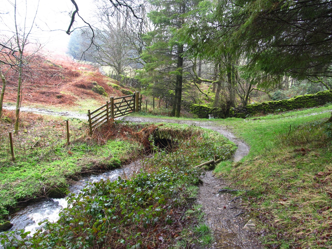
Every day that I am in the Lake District I aim to start my walks with an ascent that I have never done before, which means that I am walking up to the top of a fell that previously I had only ever visited from a neighbouring fell by a ridge route. When considering my options from the Honister Hause Youth Hostel I realised that I had already climbed all the fells that can be climbed from Honister, even though it must be at least ten years since I last stayed at that hostel. In the end I decided that I would climb Grey Knotts taking the usual route via the old tramway drum house. In 2004 I climbed Grey Knotts direct from Honister, so although I wasn’t climbing the fell for the first time I was at least taking a route that I had never taken before. At the highest point on the course of the old tramway, the site of the drum house, I turned left and followed the well-worn path that is usually taken by people on their way to Great Gable. When the path levelled I turned left and headed up the snowbound slopes of Grey Knotts.

The weather was typically terrible. It was raining when I left the hostel and by the time I had come off the path it was snowing. With a significant amount of snow underfoot I made my way up the pathless rock-filled terrain through the mist up to the top of Grey Knotts. There are several tors of rock that could potentially be the summit and even Wainwright couldn’t decide which of two of them deserved the accolade. To be sure I visited the top of all of them before making my way along the top of the broad craggy ridge to Brandreth. It was great being at the top of these fells in poor weather when the absence of any other footprints in the snow provided me with a very real feeling of exploration, but I didn’t think it would be wise to continue along the ridge towards Great Gable. I’m not a huge fan of winter walking, and I’m not equipped for it, so from the top of Brandreth, I turned to my right and headed down the broad slopes away from the snow.

Following a fence, I made my way down the long north-eastern slopes of Brandreth and realised that I had done the same thing in 2013. On that occasion I had reached a snow-covered Green Gable before turning around and descending these same, easier slopes towards Haystacks. Rather than keeping to the ridge overlooking Ennerdale, as in 2013, I now took a route that I have previously taken many times, passing close to Great Round How and joining the wide path from Honister via Dubs Quarry. It was reassuring to find that this old route was still clear and the snow that had continued to fall all morning finally stopped when I reached the Dubs Quarry path enabling me to really enjoy the fabulous rock terrain of the path as it passes the outlet of Blackbeck Tarn. Wainwright was a big fan of Haystacks remarking that the top of Haystacks is a wonderful cure that could make one forget even a raging toothache.

It certainly is a fascinating place and I so enjoyed my walk across the fell that the exploits of the demon path builders failed to dampen my enthusiasm. A satisfyingly tricky, scrambly descent led me down to Scarth Gap where I had my lunch. My original plan for this walk had been to go along the southern ridge of Ennerdale, but in view of the snow on the high fells I had decided that the northern ridge, usually known as the High Stile ridge, would be the safer option. On my first ever visit to the Lake District, I traversed the whole ridge after visiting Haystacks, but I can’t remember ever going that way since as I think all my subsequent traverses were in the opposite direction. I particularly remember climbing Gamlin End, the steep scree slope of High Crag, in baking hot weather, but now the demon path builders have built zigzags into the fellside alongside the scree, and actually done a good job. There was quite a lot of snow at the summit of High Crag and along the High Stile ridge, but as I slowly made my way along the ridge the weather gradually improved providing me with some awesome views along this fabulous ridge.

My experiences of earlier in the week had taught me that when I am excited about a walk and the surrounding scenery, I rush along unable to contain my excitement, but I knew that this ridge is far too good and too short to be traversed in double-quick time. There is nothing that can compete with this ridge once the end has been reached, so I may as well make the most of the improving weather and the fabulous fells on the High Stile ridge. This ridge deserves to be lingered over, so I wandered along the top taking in the amazing views that were improving with every moment. Slowly I made my way along the ridge to the highest point and its namesake: High Stile, and while there I wandered along the summit ridge towards Buttermere in order to take in the views towards High Crag and Red Pike, and to simply enjoy being up there for as long as possible. It is lovely to be able to stop at the top of a fell and not be in a hurry to get anywhere, but eventually I left the top of High Stile and made my way across to the top of Red Pike and the end of the ridge.

With gorgeous sunshine all around me, I didn’t want to descend, but the terrain drastically changes after Red Pike. The ridge descends steeply and broadens into featureless grassy domes that lack the interest of the dramatic crag-filled fells of the High Stile ridge. There was no snow on these lower hills and I couldn’t see the point in prolonging my walk onto these dull hills after the fabulous High Stile ridge, so I turned south towards the steep, grassy slopes of Red Pike. There is a footpath that descends these tedious slopes and once I had located it I dropped quickly all the way down into Ennerdale. After my mammoth expedition of the day before, I had maybe needed this relatively more sedate walk. I’m not a huge fan of walking in snow, possibly because you have to be more careful than usual, and maybe that is why I preferred my walk over Haystacks than over any of the other fells, but this was still a great walk in changing weather conditions through snow covered fells and over awesome rock-filled mountains.