Thursday, 25 July 2024

Ben Bhraggie, Big Burn and Dunrobin Castle

Thursday 30th May 2024

When I drove up to Scotland in 2010 I took a great tour around the North Highlands echoing parts of the popular NC500 long before it was launched, but I have not been back to the historic county of Sutherland since. There were mountains in the area that I had not climbed on that occasion, partly because of poor planning and also because of bad weather, so I wanted to return and therefore my principle goal for this holiday was to return to Sutherland. To start, I left the Cairngorm Mountains and drove through the city of Inverness along the A9 up the east coast into the historic county of Sutherland and eventually stopped in the town of Golspie. I did not do any walking in this part of the county in 2010, preferring the more mountainous west coast, so this time I thought I’d start with a walk in this south eastern corner. Overlooking the town is a monument to the first Duke of Sutherland who is quite a controversial character for his part in the Highland Clearances when thousands of people were evicted from their homes to make way for sheep farming, but I just thought it would be good to walk up the hill the monument sits on. In glorious sunshine I set off up the hill, initially on a road, and as I climbed the views over Golspie and out to sea were increasingly spectacular, especially after what has seemed like months of rain this year. It was great to be finally getting great weather, but as I approached the monument I was hit by strong winds coming off the hills that made the walking considerably less enjoyable.


The views were stunning but it was only while standing on the seaward side of the monument that I was really able to appreciate them as when I moved inland along a clear path towards the top of Ben Bhraggie I was hit by strong winds. This path soon circled around the northern slopes and descended back towards the sea and I was more than happy to be out of the wind as I re-entered Ben Bhraggie Wood. The path led me past the conifers to a signpost that showed the route back to Golspie, but I had other plans. I had found a walk on the OS Maps app called ‘Country Walking: Ben Bhraggie, Highland’, which now directed me into the glen of Golspie Burn where a walk described as Golspie’s hidden gem, known as the Big Burn Walk, took me through a delightful wooded gorge. At a road I crossed the burn and took a path into the wood beside the stream where waterfalls were the star attraction, though I was also attracted to the woodland flowers that could be seen at this time of the year scattered throughout that included bluebells and later wild garlic. The well-constructed path took me safely through the gorge and eventually brought me to the foot of a tall waterfall that was not as impressive to me as the deep, cavern-like gorge surrounding the falls that had been created by the slowly eroding action of the waterfall. The fabulous path continued through the impressive gorge where woodland flowers decorated the rugged scenery, notably wild garlic, but all too soon my delight came to an end at the A9 trunk road.


On the other side of the road I followed a path through woodland abundantly decorated with flowers, though sadly now mostly gone to seed, not far from the beach as I followed the coast through to Dunrobin Castle. This is the seat of the Duke of Sutherland but I had no interest in going inside so I quickly made my way past the tourists, continuing through the woodland and soon I was out onto grassland than ran alongside the shingly beach for a relatively tedious walk beside the coast until I reached the ancient, circular, fortified dwelling called Carn Liath Broch. I have seen visited brochs and this one is less impressive than others I have seen, notably in the Outer Hebrides. As clouds began to envelop the skies I made my way back along the coast over the grassland and on re-entering the woodland around Dunrobin Castle I kept to the coast passing below the castle and formal gardens through wildflower-rich meadows. While the sun came out again, the monument on Ben Bhraggie could be seen ahead standing over Golspie and I re-entered the town at the end of a varied walk with three very different stages. From the wind-swept hilltop with extensive views to the fabulous gorge walk I finally ended with a coastal walk past Dunrobin Castle. After all the rain of this year, the sunshine on this walk was a welcome change and was the highlight of the walk.

Saturday, 20 July 2024

The Abernethy Forest

Wednesday 29th May 2024

My goal for coming to the Cairngorm Mountains had been to climb Ben Macdui and visit Loch Etchachan, which I did the day before this walk, so despite the weather being poor I was not really bothered as I had nothing planned. Instead it gave me a chance to explore the lower levels of this delightful area and there is one path near the youth hostel at Glenmore that I always take when in the area but first I had to find it. Starting beside the Reindeer Centre, I set off along uninspiring forestry tracks through a conifer plantation and once I’d started walking the fact it was raining failed to put me off and it soon stopped to be replaced with general murkiness. The dull track eventually came to an end, with views over the trees into the misty surroundings, beside a sign that proclaimed that the path ahead was no longer maintained and may be rough underfoot. I was rather disappointed by this as I love that path and would hate for it to become impassable at some point, and the fact that it is rough is part of its appeal for me. Another part is the wild flowers that often grow amongst the deciduous trees in this part of the Glenmore Forest Park, though on this occasion many of the flowers had already gone to seed. The most abundant was the slender blue flowers of bugle and the path itself was very enjoyable, weaving around the trees, up and down through the landscape. Wide flat paths are no fun in comparison.


Eventually I descended steeply to the main track through the Pass of Ryvoan near to An Lochain Uaine whose green waters are iconic. The path continued to climb away from the loch and split with the right hand branch turning south to the River Nethy heading over the Lairig an Laoigh and the other turning to the north climbing up to the Ryvoan Bothy. The Lairig an Laoigh is a fine pass through the mountains that I previously took in 2009 from Braemar, but I have not been any further along the other path than the Ryvoan Bothy where a path diverts up to the top of Meall a’ Bhuachaille, which I took in 2021. Now I stayed on the path beyond the bothy passing through moorland sparsely decorated with young trees and into the Abernethy Forest following the clear track past the conifers of scots pine. Junctions presented a challenge in navigation, though the route to Nethy Bridge was usually the clearest and often signposts pointed the way. Showers came and went throughout the course of the morning while I slowly made my way along the track with no sign of another soul amongst the trees. Despite walking through conifers, this always felt much more alive than when in a man-made conifer plantation because there was more space between the trees which allows more light to get to the woodland floor and so there was plenty of vegetation growing underneath the trees. All this is in sharp contrast to the dark, lifeless floors of conifer plantations.


Eventually I began to see signs of civilisation, first at Forest Lodge and then later, after tarmac appeared underfoot, I entered the outskirts of Nethy Bridge. In the centre of town I saw a sign for a riverside walk and since I had plenty of time before the next bus was due I took advantage of it and the sunshine that had just appeared. There were many wild flowers to admire, but the star attraction was the River Nethy itself, which was looking stunning under the blue skies that had astonishingly appeared, so when I reached the end of the trail I turned around and walked back along it. I was enamoured of Nethy Bridge and wanted to spend more time exploring but I didn’t want to miss my bus so I waited around for it to appear and by the time it eventually did the rain had also returned. The Speyside Way passes through Nethy Bridge so if at some time in the future I decide to do this long distance trail then maybe I will have an excuse to return to this village and spend more time there as I enjoyed my brief time spent in Nethy Bridge waiting for the bus in the sunshine. I was brought to Aviemore where I could either catch another bus to take me back to the youth hostel or I could walk there, which I have done on many occasions. Considering the time, I decided to take the quickest route along a cycle path known as the Old Logging Way, which I had taken in 2021 when I was last in the area. The rain held off even though it looked like it wouldn’t and provided me with another relaxing walk except when dodging bicycles.


This was a very different walk to the one the day before and I definitely prefer being at the top of a mountain but that holds less appeal when the clouds are low, though the weather was actually not as bad as had been forecast. It had given me the opportunity to explore the Abernethy Forest which I had not previously visited so the forecast did have that advantage and it was enjoyable and relaxing even though walking through woodland can be rather monotonous.

Friday, 12 July 2024

Ben Macdui and Cairn Gorm

Tuesday 28th May 2024

After my walk on the day before this past the Falls of Clyde, I set off north to drive all the way into the Highlands and to the Cairngorm Mountains to stay at the Cairngorm Lodge Youth Hostel. The following morning the weather was fantastic with blue skies and bright sunshine, the perfect day for mountain walking, but unfortunately the forecast revealed that it was not to last and it would be raining by afternoon. Undeterred I headed as quickly as possible into the mountains before the weather deteriorated, driving up to the Coire Cas car park where I was able to benefit from starting more than two thousand feet above sea level. The last time I was in the area was three years ago when I climbed Ben Macdui with Abbie Barnes of Spend More Time in the Wild as part of the Abbie Bikes Britain campaign. I had already planned to climb Ben Macdui on that day by a route via Loch Etchachan that I had originally planned on taking in 2005, but I hadn’t been able to resist the opportunity to join Abbie, though I was disappointed to not be ascending that way in excellent weather. Even though I was now finally able to climb Ben Macdui by way of Loch Etchachan I turned the walk around to descend that way instead and get up onto the plateau as soon as possible. Initially I set off on the same route I had taken three years ago, but when I reached a junction I turned left so I wouldn’t be repeating myself.


The weather was great at this point with extensive views towards Loch Morlich, but it wasn’t long before clouds began to cover the skies and put a grey cast over the scenery. The path took me up into Coire an t-Sneachda, which I hadn’t planned on entering so I had no idea how I would get out of it. The Ordnance Survey map reveals a path that climbs the corrie wall, which I have taken before, though all the way back in 2005, or alternatively I could turn left to climb Fiacaill a’ Choire Chais or right to climb onto the ridge on the other side of the corrie. There is a serious scramble at the end of Fiacaill Coire an t-Sneachda up the Fiacaill Buttress and I have harboured a desire to attempt it for almost twenty years and I could not resist the temptation now, so I branched off the path and climbed the boulders that cover the slopes of the ridge until eventually I reached the top. The sunshine overhead had already disappeared by this point while a cold wind was blowing towards me from off the escarpment. When I reached the foot of the buttress I attempted to follow the obvious route up but soon I bailed out thinking that it was too steep so I turned to the right to look for an easier route up. Perhaps I would have continued to climb fifteen or twenty years ago but in my old age I was quick to turn back, which is no bad thing and ensures that I didn’t get into difficulty that I couldn’t get myself out of.


Instead of finding an easier scramble up I found a path that bypasses everything crossing the slopes to the right of the ridge. I was a little disappointed to have so easily bailed out and I wish I had looked better for a route up but I have taken so many bypassing paths over the years I was not really too bothered and eventually, after a steep ascent, I reached the top of the ridge, which was still very satisfying. Now I was exposed to the harsh wind coming over the Cairngorm plateau so I zipped myself up and headed to the top of Coire Lochan, which at 1215 metres is one of the highest peaks in Britain, though it is only classed as a top and not a separate mountain. Turning into the wind I headed towards Ben Macdui across pathless slopes while the sun occasionally broke through the clouds and the weather seemed to improve to provide me with stunning views towards the neighbouring mountains either side of the plateau. At Lochan Buidhe I joined my route of 2021 and followed the cairned path across a stony landscape to the top of Ben Macdui which was clear of clouds, though windy and the clouds above the summit were becoming darker. Mindful of the impending rain I soon made my way along the path towards Loch Etchachan passing the ruin of the Sapper’s Bothy and alongside the crags above Coire Sputan Dearg. The views before me were sensational despite the darkening clouds as I thoroughly enjoyed the descent along a path that I have wanted to take for many years.


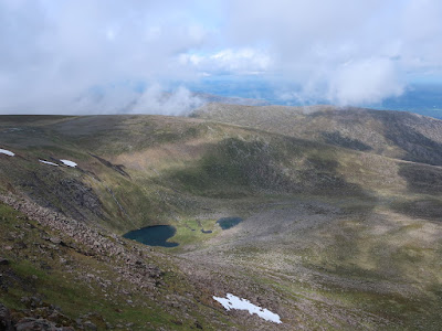
I previously passed Loch Etchachan in 2013 and, even though it was almost the same date as on this walk, winter still had an icy grip on the loch almost completely freezing its waters. That visit etched in me an abiding memory of the landscape that had now drawn me back so it was a shame that the weather was so poor and I wasn’t seeing the loch at its best. I continued my descent along the path that leads steeply down to the western end of Loch Avon where there is an awesome surround of crags but I had a problem: Cairn Gorm was in my way. A long line of mountains barred my way back to the car park so I had to climb back up to the Cairngorm plateau again, but first I made my way down the eroded path to the scattered boulders below Shelter Stone Crag, many of which one can actually shelter under. The eponymous boulder has the largest cavity and was identified by a pile of stones on top so I made my way there to have a look inside where I found a bit of debris left behind by previous occupants but I wasn’t about to take the opportunity myself so I made my way down to the river and after safely crossing I turned towards Loch Avon. In 2005 I had been faced with a similar problem and on that occasion I had climbed up to the Cairngorm plateau by a very difficult path beside Allt Coire Domhain that is not shown on Ordnance Survey maps, so this time I decided to take an easier route that climbs into Coire Raibeirt and I found an excellent path that was a joy to take.

As the rain finally began to fall I followed the stream up into the corrie and back onto the Cairngorm plateau where I had a choice of paths to take back down and despite the increasingly bad weather I decided to turn right and climb the tedious slopes of Cairn Gorm to reach the summit of the mountain that lends its name to the range and the National Park. I ignored the weather station near the summit to reach the cairn that marks the top but I didn’t linger and soon I was passing down the cairned and later roped path. I have previously gone out of my way to avoid this tourist route but the Ptarmigan Restaurant and the mountain railway were both closed so I made my way around and once past the ski slopes I had an enjoyable descent down Sròn an Aonaich. This was an epic walk even though I was making up the route as I went along, starting with climbing Fiacaill Coire an t-Sneachda, which I had not planned on doing. After waiting almost twenty years to climb Ben Macdui by way of Loch Etchachan, I actually found that it is better to descend by that route and I’ll be keen to return some time and camp beside this delightful loch. I am glad the weather held off until towards the end and I was able to make the most of an awesome day in the Cairngorm Mountains.

Thursday, 4 July 2024

The Falls of Clyde

Monday 27th May 2024

I didn’t stay in one place for very long during my holiday in Scotland, so after just two nights in the town of Moffat in the Southern Uplands I drove north through heavy rain to the World Heritage Site of New Lanark beside the Falls of Clyde. When I got there I was pleased to find that I had left the heavy rain behind and the sun was breaking through the clouds as I made my way down the hill to the village that was founded in 1785 to provide housing for mill workers. I had planned to visit this area at Easter in 2020 at the end of the Clyde Walkway but after that holiday was scrapped because of Covid I found I was no longer interested in doing the Clyde Walkway, though I still wanted to visit the Falls of Clyde which had perhaps been my only motivation for doing the walk in the first place. It was not New Lanark that had interested me, rather it was the waterfalls on the River Clyde that attracted me to the area, and so I was soon past the buildings and joined the route of the Clyde Walkway into the Falls of Clyde Nature Reserve and fabulous woodland. Some bluebells had survived the hot weather of earlier in May along with several other woodland flowers, but generally most of had gone to seed, though this failed to detract from my enjoyment of the walk. An excellent path afforded me with viewpoints into the gorge where I was able to get a glimpse of the awesome spectacle even though the views were sometimes obscured by rapidly growing vegetation.


The first waterfall is Dundaff Linn which could be seen from New Lanark but a closer look was not possible due to intervening trees. Beyond, I walked along a wooden boardwalk that helped me get close to the water, which at this point was gently moving and hardly hinting at the ferocious power of the falls upstream. Corra Linn was the next waterfall that I saw and this was spectacular in its woodland setting falling into a vast, steep sided bowl that forced me to climb high to get around it. The path always kept me safely away from danger but sacrificed up close views that would have been more dramatic. When I had finally had enough of the scene I resumed my progress along the path, always keeping right whenever I reached a junction to maintain my course beside the river even though this sometimes only led me to a viewpoint whose exit was the way I had come. The third and final waterfall was Bonnington Linn which was broader than Corral Linn and encompassed several branches thanks to a small island in the river where a now derelict bridge would have previously taken people across the waters but no more. I was able to safely cross the river just above Bonnington Linn and from there I returned along the opposite bank where more viewpoints afforded me with stunning sights of the waterfalls, though overgrowing vegetation proved constantly frustrating.


After passing Corra Linn I settled into a pleasant woodland walk that would have justified coming here even without the waterfalls. A few fallen trees provided me with a tricky obstacle to circumvent especially as I couldn’t see the path on the other side but once I passed I was able to continue the walk beside the river and past New Lanark where there is no way across the river. After passing New Lanark the path widened underneath thick woodland and while underneath it started to rain heavily, so clearly the heavy rain that I had encountered on the drive north from Moffat had now caught up with me, so while sheltered under the trees I put my waterproofs on before continuing along the trail through the woodland with little or no view of the river to my right. Eventually I emerged onto a road where I turned right to reach Clydesholm Bridge where I was in doubt as to the onward route back along the northern bank of the river. There was no sign to indicate the route of the Clyde Walkway and the most likely route was through a shut gate beside a private residence. After a long time spent wandering around and looking at maps, I eventually decided there was no other place to go so I went through the gate and soon I was beside the river on a very wet path that was clearly the Clyde Walkway.


As the rain began to ease I climbed the steep bank to reach a road before descending a zigzagging path through Castlebank Park that brought back down to the river and after passing through Braxfield Park I climbed once more to reach the New Lanark Road. This was an amazing walk that saw me pass stunning scenery through the narrow valley of the Clyde where several waterfalls mesmerised and enthralled me. I was fortunate to have sunshine while passing the falls and for the rain to wait until I had reached the less interesting section of the walk, and I thought that I must have been benefiting from the large amount of rain that had fallen this year to produce such spectacular waterfalls that were worth the wait.