Thursday 29th December 2005
For the last of my walks in the Peak District from 2005 I took advantage of clear weather to leap into the car and drive up to the Peak District for a walk around the Kinder plateau. I have walked around most of the top of Kinder Scout, but I had never been all the way around and I had also never been to the trig point at Kinder Low, so I was determined to correct these oversights while walking in very cold weather. I parked in a lay-by near to the Snake Pass Inn and crossing the road I passed through the wood crossing the River Ashop onto open country where I forded the Fair Brook and walked up Gate Side Clough beside a broken wall up onto the edge of Kinder Scout. There was a thick layer of frost covering the whole landscape under blue skies that provided me with tremendous wintry scenes as I slowly climbed up to the rocks on the northern edge of the Kinder plateau. The view north from the rocks at the top of the climb was spectacular looking across the Woodlands Valley at Oyster Clough and the deep gouge it makes into Alport Moor with Bleaklow visible on the horizon. Climbing a little further I reached the path that circumnavigates Kinder Scout and proceeded in a clockwise direction around the edge of the plateau across the top of Blackden Clough until I reached a point due north of the trig point at the eastern end of Kinder.

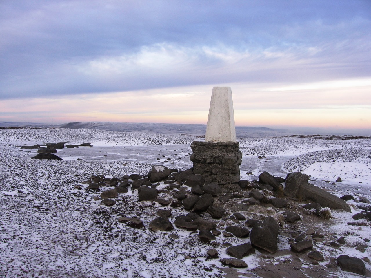
Striking out across the frosty heather I made my way across to the 590m trig point where I stopped to admire the view across the bleak and deserted moor. Turning towards Edale I headed towards the southern edge of Kinder Scout and reached the perimeter path near the top of Golden Clough. I was now in plenty of company as I started walking around the most popular half of Kinder Scout. From the top of Golden Clough along the southern edge and all the way along the western edge to the top of William Clough there were many other people in the clear, bitterly cold weather also enjoying the edges of the Kinder plateau. The views of Edale to the south, however, were marred by the low sun and low clouds blowing over the Lose Hill-Mam Tor ridge so any pictures that I took in that direction didn’t come out very well. With low cloud threatening to ruin my day I proceeded around the top of Grindsbrook Clough, across the head of Crowden Clough and through the assorted rocks known as the Wool Packs. I have been along this path many times so the assorted weathered rocks held little interest for me and the paved path was no longer the challenge it once was, and besides in this weather the bogs were all frozen solid.

Eventually I reached the Swine's Back (a low hill at the top of the Jacob's Ladder path) where I had my lunch. After visiting the Edale Cross, a medieval cross at the high-point between Edale and Hayfield, I returned to the Pennine Way and followed it past Edale Rocks to Kinder Low, which is the south-westerly trig point on Kinder and as close to the summit as is possible without a bit of guesswork. The trig point stands at 633m, while the highest point on the plateau is 636m somewhere north-east of Kinder Low. I had never actually been to Kinder Low before, but I don't really seem to have missed anything despite this being a very popular place with many people crowding the summit. It is funny how the other two trig points weren't as popular as this one! Continuing along the Pennine Way, the Kinder Downfall was clear for me to see ahead as my next port of call where the waterfall was completely frozen but I still couldn't get a good enough picture of it.

Rejoining the path after my fruitless clambering on the rocks around the Downfall I headed along the edge until after crossing a fence I headed out across the frozen wasteland to the third and final trig point on Kinder Scout. Judging by the total lack of footprints around the 624m trig point it didn't seem like anyone else had been to visit it recently, but they were missing a stunning scene across the wide expanse of the Kinder plateau. The remainder of the walk involved my heading north over the frozen bogs onto the northern edge of Kinder, where I headed east beside the northern edge around Fairbrook Naze and down Fairbrook Clough in darkening conditions back to my car. This was a fun walk in very cold weather, but I was still a little disappointed. I was hoping for some good pictures of Edale but the conditions just weren't cooperative enough and also to be honest I was hoping for a little more snow. The year before I did a walk along the northern edge of Kinder Scout in wintry conditions when the snow was much thicker and I was hoping for similar conditions again, but that wasn't to be the case.


No comments:
Post a Comment