Saturday 4th May 2024
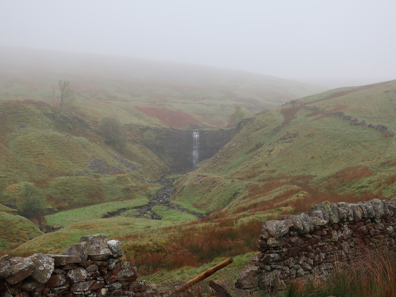
I attempted to do the Dales High Way last year, which runs across the Yorkshire Dales from Saltaire to Appleby, but I abandoned it when I reached the market town of Settle because of bad weather and ill health. I was keen to complete the trail over the May Day Bank Holiday weekend even though it would involve some long days and challenging accommodation. My experiences in Dartmoor the month before made me question whether it would be wise to attempt this and yet despite poor weather I caught a train back to Settle and with the weather not much better than it had been when I’d abandoned the trail last year, though at least it wasn’t raining yet, I set off along the Dales High Way. Initially I was also following the route of the Ribble Way on a section that I had followed ten years ago and remembered as being filled with wildflowers so I had been looking forward to it. Wild garlic was the most abundant flower as it covered the banks above the river, but there were also bluebells which are usually at their best at this time of the year and also other flowers that I would normally associate with Easter such as primroses and celandines. Eventually I reached the waterfalls of Stainforth Force where I took a moment to look at the falls while it started to rain, though only briefly.

At the bridge above the falls I turned left to move away from my route of 2014 and start to climb through Little Stainforth onto the open hills and the low cloud. There is something rather eerie about walking in these conditions, especially as there was little wind as I climbed over the pass below Smearsett Scar and down into the tiny community of Feizor. I briefly passed this way last year but now I was heading in a different direction, north along a lane over a low hill and across several fields into Wharfe where a bridleway above the hamlet was lined with beautiful wildflowers including forget-me-nots and bluebells plus large yellow flowers that I could not identify, possibly a garden escape. This lane took me over Austwick Beck beside a picturesque clapper bridge and past Crummack Farm before heading out onto the open hillside as the weather worsened. A maze of paths took me across the wide landscape east of Ingleborough while the rain began to fall and two mountain rescue vehicles passed by me eventually stopping at the junction with the route of the Three Peaks Challenge, beside Nick Pot. Vast numbers of people were streaming down the path, including many engaged in an Ultramarathon, and the path was very muddy, which was a surprise as elsewhere the paths had been surprisingly dry, particularly beside the River Ribble.

It was unpleasant trying to get up Ingleborough past the crowds of people (and the incident that had called out the mountain rescue) in bad weather and on a very muddy path for what seemed to be many miles. This left me questioning the wisdom in continuing along the Dales High Way, but since I had no accommodation booked I felt my options were limited. Just before I reached the summit of Ingleborough the rain eased and I reached the junction with the route down the other side which I took ignoring the actual summit. I have been there before and didn’t need to go there and back to this junction. The descent is prodigiously steep over rocks and I would have appreciated it more in ascent and in the dry. Astonishingly, I have previously been this way just once before, almost twenty years ago in ascent, so I have little memory of it. This time I had to negotiate my way vast numbers of people who were all coming up while I was the only one coming down, however, the path was excellent and a joy to traverse especially in contrast to the state of the path down the other side. I was rather frustrated lower down at not getting a good picture of the limestone pavement of Southerscales Scars, though I would needed to have made only a little effort by coming off the path.
At the bottom I turned left along the road, past the Old Hill Inn and turned right soon after onto Philpin Lane, which is the route of the Three Peaks Challenge. The Dales High Way diverts through the hamlet of Chapel-le-Dale, but it is not necessary and this way I cut a mile from the route. At Bruntscar I joined the Dales High Way again and my route of last year when I had come up from Ingleton. In my dreams, while planning this walk, I had thought I would now continue on the route of the Three Peaks Challenge up Whernside, but this is a ‘hard slog’ and I didn’t have the energy for it so I kept to the trail heading towards Ribblehead Viaduct, which could barely be seen through the mist. After passing underneath the railway line I turned left to head up the hill back on the route of the Three Peaks Challenge and it was curious to note how much easier this climb was for me now compared with how difficult it had been for me last year when I had not been feeling well. I ignored the turning towards Whernside on the Three Peaks and followed the path over the hill that would eventually bring me into Dentdale but not until very late in the evening so instead I stopped at the top of the pass and put up my tent. The weather was quite good at the start of the day and I enjoyed the walk beside the River Ribble past many wildflowers but as I climbed Ingleborough the weather worsened and walk was quite trying, but in the end I kept to the Dales High Way, which was quite surprising after considering to give up on several occasions, but the weekend would improve from now on.
No comments:
Post a Comment