Thursday, 3 July 2014

Conistone Dib and Grass Wood

Saturday 26th April 2014

This walk started in the rain, which is always a depressing thing to do because you never believe that it’s ever going to get better and you feel that you’re doomed to walk in the rain all day even though that is actually rarely the case and it wasn’t now, partly because after lunch I caught a bus to go home. For the last walk of my holiday I decided that, mainly due to the weather, but also due to buses not running at convenient times down Wharfdale, I would walk to Grassington. My original hope for this day had been to do a walk further down Wharfdale near Bolton Abbey, but a lack of buses through the valley forced me into doing this smaller and less significant walk instead. My plan was to follow the Dales Way, which I’d followed into Kettlewell the day before, so I set off in the pouring rain along the road until just after passing Scargill House I turned left to walk up Highgate Leys Lane. This track leads all the way onto the high moor, but the Dales Way soon leaves the lane to make its way across a gently contoured hillside past many ancient enclosures to eventually reach the limestone outcrops of Swineber Scar.

The visibility was very poor and the misty scenery was so unappealing I just kept my head down and kept going past the limestone scars, stopping just once, at the top of an outcrop of limestone known as Conistone Pie, but as fascinating as this large rock was, the surroundings were so grey and misty that I didn’t stay very long before resuming my walk along the Dales Way. It wasn’t long until I reached Scot Gate Lane and the top of Conistone Dib, which is an interesting narrow valley full of rocks and with steep grassy slopes, but I was at the top of it. Walkers on the Dales Way bypass this peculiar feature with barely a glance but I wanted to explore it and that entailed carefully climbing down the wet rocks into the valley and then walking all the way down it. There is reportedly a spectacular gorge at the bottom of the valley, but unfortunately I didn’t descend that far, which is a pity and with hindsight I wish I had descended all the way into Conistone.
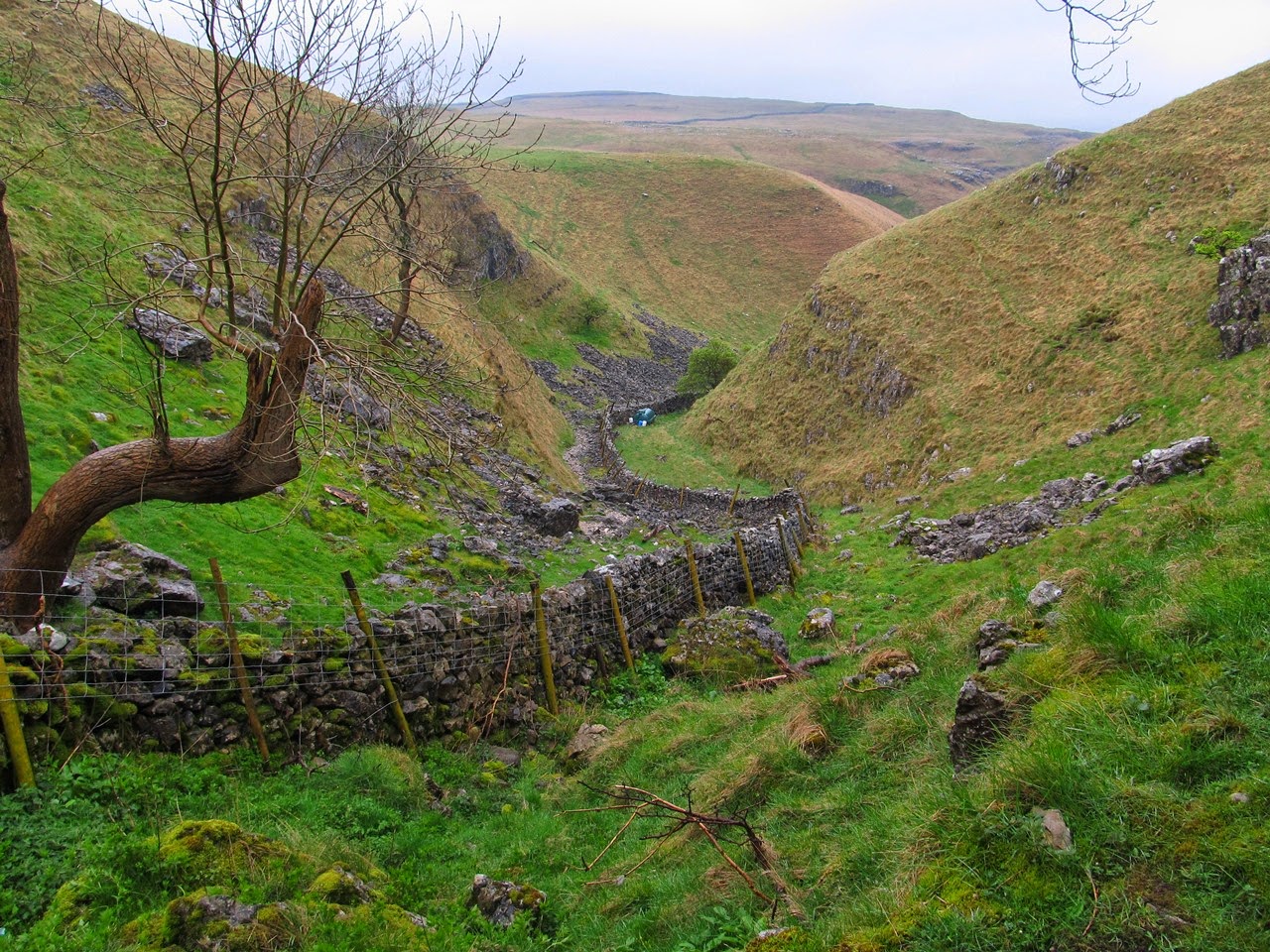
Instead I climbed back out of the valley and onto the Dales Way to resume my walk south towards Grassington as the rain eventually eased. I passed more limestone features, but I wasn’t finding the scars particularly interesting while an old lime kiln near the path was more successful in drawing my attention. On this holiday I have to admit that I was not impressed with the subtle limestone features of the terrain as it seems I prefer the bolder, more dramatic features of volcanic regions like the Lake District. The botanic features of the landscape, meaning the wild flowers, were by far the biggest draw of the week, and the banks of primroses that I saw in many places were the definite highlight while the limestone scars failed to excite me (however I was impressed with the enormous limestone pavement of Moughton, near Ingleborough, which was a definite highlight despite being there when it was raining).

In a bid to find more wild flowers I turned right once I was off the open access land and headed for Grass Wood, which I’d heard was particularly good for bluebells, however I was disappointed with it. After all the wild flowers that I’d seen on this holiday Grass Wood was unable to compare favourably, though it’s probable that I was just too early and if I’d returned a couple of weeks later I would have seen a stunning display of wild flowers, particularly bluebells. As I made my way through the wood I did see many wild flowers but they were not in the abundant numbers that I had seen in such places as on my first day of this holiday, near Aysgarth Falls. Despite the scarcity of woodland flowers I did think it was a charming wood as I negotiated a course past Gregory Scar and around Dewbottom Scar descending to the road at the bottom of the valley.

In the narrow strip of land between the road and the river I found a much more abundant display of wild flowers including banks of bluebells newly in flower. Primroses and wood anemones were also on display that went some way to reducing my disappointment in Grass Wood. I think my problem is that I’ve seen better, but timing is so critical with woodland flowers that I could come back a week later and find a completely different display. A delightful walk beside the River Wharfe took me through the wood to a set of rapids with the peculiar name of Ghaistrill’s Strid that were fun to explore, while clambering over the rocks beside the river to get a closer look. Continuing alongside the river I eventually rejoined the Dales Way as I walked past Grassington until I reached Linton Falls. After a good look at this waterfall that is marred by old factory buildings beside the river I made my way along a path up into the village of Grassington to the National Park Centre.

There I enquired as to the next bus to Skipton only to learn that I had just missed one and the next was an hour and a half away. My disappointment was further increased by the weather that had promptly cleared now that I had stopped walking to leave glorious sunshine for the rest of the day, however Grassington is not a bad place to spend an hour and half. This walk hadn’t been too bad, especially after the rain stopped, as I did enjoy the end of the walk wandering around Grass Wood and beside the River Wharfe. It might have only been lunchtime but I think I was ready to go home. As for the whole holiday, did I see the gems that I’d been hoping for? I saw a few gems, and not a few waterfalls, but I didn’t appreciate the difficulty in finding those gems. Ultimately the Yorkshire Dales cannot compete with the Lake District or similar places. Pot holes and limestone outcrops might not hold much interest for me, but there are things in the Yorkshire Dales that are really appealing so I'm sure I will be back, even if I have to wait another five years.

Friday, 27 June 2014

Pen-y-ghent Gill and Horse Head Moor

Friday 25th April 2014

This was the last full day of my holiday, and unfortunately the weather was terrible. There was low cloud at the start of the day, but at least it wasn’t raining, however it wouldn’t be long before that changed. My original plan for this walk had been ridiculously over-ambitious and would have taken me over twelve hours even if the weather had been good. The walk started and ended in the village of Kettlewell, where I had been staying in the youth hostel, and as originally planned would have included the Pennine Way between Pen-y-ghent and the Cam High Way. It is far too easy to underestimate how long a walk is going to take and only long experience can avoid this, but fortunately I had already realised my error and revised my plan. I still planned to walk up Pen-y-ghent, but to return to Wharfedale directly, which I think this was a reasonable walk to do, but in the end the weather prompted me to abandon Pen-y-ghent and turn back before I reached the hill.

Despite all these carefully laid plans as soon as I walked out of the door of the youth hostel I turned towards Top Mere Road that would have taken me in the opposite direction and up to the top of Buckden Pike. Soon after leaving the village at the start of the lane I saw how low the cloud was and realised that the weather was not good enough for a walk up Buckden Pike so I decided to do the walk as planned. Returning through the village I crossed the river and followed a good path that climbs over the top of Old Cote Moor scrambling through some scars on either side, and descended through heather. The highlight of the crossing, and indeed of the day, was Byre Bank Wood near the end of the crossing, just before I reached the tiny village of Arncliffe, that was packed with an abundant display of wild flowers. There were bluebells, primroses and everything else that you could possibly want in a wood, making it a magical place that was a joy to walk through, but all too soon I was in the village of Arncliffe.

Unfortunately the walk failed to live up to that early promise as I plodded along the bottom of Littondale with little to interest me except for the seeming theft of the water in the river at the bottom of the valley. After passing the village of Litton I started to climb into the valley of Pen-y-ghent Gill on a track high above the stream where there are many limestone features marked on the map, such as pot holes, caves and rocky ground, but from the lane and in the poor weather I couldn’t get a good look at them. As this week progressed I was beginning to wonder whether I was really that interested in these sort of limestone features as it seemed that I am perhaps more interested in bigger rock landscapes such as in Gordale Scar or in a huge, steep-sided, craggy mountain while the smaller scale water-eroded features of limestone pales in comparison. I prefer features that are bold and in-your-face rather than things you can’t see like underground channels, but ultimately it was the weather that ruined this walk because whatever there was to see was always going to look dull under dark clouds.

With the conditions failing to improve I decided to turn back and crossed the valley when I reached the road to return to Littondale on the other side. Instead of following the road all the way back I took a path a little below that was initially quite interesting as it passed many limestone outcrops and provided me with good views down into the sharply cut valley of Pen-y-ghent Gill. However, instead of lingering in this fascinating area I quickly left the limestone far behind me and allowed the dreary weather to reassert its influence on me as I grew tired of the walk on the path until finally I returned to the road where, in a sheltered spot, I had my lunch before setting off along the road all the way into the tiny village of Halton Gill with the long anticipated rain started to fall just as I set off and accompanied me for most of the rest of the day.

On the other side of the village I took a track that headed steeply up the side of the hill over Horse Head Moor while the rain began to fall more heavily. This is supposed to be quite an ominous crossing (probably due to its ominous name), but despite heavy rain, low clouds and wind I had no problems. I was not worried about the prospect of crossing Horse Head Moor in bad weather, though it did occur to me that some might, but long experience has taught me that that so long as I was able to follow the path I would have no problem and there is a clear track all the way up to the top and on the other side a very boggy but clear path led me down. Just before reaching the bottom I considered my onward course. My plan had been to join the Dales Way at Yochenthwaite, but in view of the poor weather, and to save time, I decided to walk along the road which took me past the village of Hubberholme and just before I reached Buckden I finally joined the Dales Way.

My walk down Wharfedale as I made my way back to Kettlewell wasn’t too bad as the rain had now eased which afforded me with a relaxing stroll for the last section of the walk. This was not a great walk mainly because I didn’t have very good weather, but also because the scenery wasn’t great. The best scenery was near the scars at the top of Pen-y-ghent Gill but the weather was so poor, even if it wasn’t raining at that point, that I wasn’t able to enjoy it as much as I should. The weather made the scenery so dull and gloomy that it seemed unappealing to me, which was the opposite of the day before where great weather combined with great scenery made for a great day, but no kind of scenery could have rescued this day. Considering the weather, this wasn’t such a bad day and afterwards I actually considered it a satisfying walk, as any in Yorkshire must surely be.