Friday, 11 July 2014

Loch Faskally and Ben Vrackie

Sunday 25th May 2014

On the first day of my annual holiday in Scotland I thought I’d start with an easy walk to ease myself into the start of two weeks. I wouldn’t go up any mountains on this first day, but instead I would do a nice, easy walk around Loch Faskally, which is a narrow reservoir near to the tourist town of Pitlochry. I was in Pitlochry for the first time last year and loved the place despite a fleeting visit so decided to start my holiday there this year. I had decided that I needed a bit of time to rid myself of the stresses and strains of working life before starting to do some hard walking in Scotland, but as always things didn’t go according to plan and I couldn’t resist going up a mountain. The day before this walk I travelled up to Scotland on the train, and since I didn’t get to Pitlochry until twenty past three I didn’t have time to do anything except look around the Blair Athol Distillery. Incidentally I was the only person from Britain on the tour, everyone else was from overseas, and I was the only one who’d been around a distillery before – I’ve been around loads!

To start my walk the day after I descended through the town down to the River Tummel and, while the ground was very wet indicating that it had just been raining, it had fortunately stopped just before I left the youth hostel. Upon crossing the river I turned right and followed signs for the Killiecrankie Path, one of a number of good, way-marked routes in the area around Pitlochry. A pleasant walk beside the river took me past the Festival Theatre until the huge Pitlochry Dam came into view, but of more interest to me was the fish ladder that enables migrating Salmon to bypass the dam on their way to the spawning grounds beyond. The path led me up beside thirty four pools that gradually climb all the way up to the top of the dam with Loch Faskally behind it and the pleasant walk continued past a small grove of Rhododendron until I reached the busy trunk road of the A9. There I turned onto a quiet lane that runs alongside the loch for a long way, passing under the A9 at the point where the trunk road soars over Loch Faskally, while I continued drearily walking along the road for seemingly many miles.

The walk on the road was so long that I lost track of where I was on the map eventually becoming completely confused and totally misreading the map. Even after passing the imposing arch that marks the road to Clunie Power Station I still failed to realise where I was, even though the power station is clearly marked on the map. Fortunately the signs directing the Killiecrankie Path knew where they were and they unerringly encouraged me to continue along the road until eventually I reached the Linn of Tummel and finally I came to my senses. On this side of the river I found a steep, narrow, and at the times, muddy path that led me down to the river where the rapids could be explored to my heart’s content, but the wet rocks made me extremely cautious in my exploration. A second path further up the road led to drier rocks that enabled me to get some good views of the river as it thunders over the rocks on its way to Loch Faskally.

Even further along the road was the Coronation Bridge, which I crossed to reach the other side of the River Tummel where an excellent path led me back past the rapids of the Linn of Tummel with better views of the river possible from the path, but access down to the river wasn’t possible due to steep edges. This pleasing woodland path took me back towards Loch Faskally and around a sharp corner to head north alongside the River Garry towards Killiecrankie. After passing Garry Bridge I left the Killiecrankie Path at the point where it leaves the riverside as I crossed the river onto the busy path through the pass that I had walked along last year on my way from Blair Atholl to Pitlochry. On that occasion I had noticed the presence of the Linn of Tummel and decided that I wanted to return to this area to visit the rapids and so this walk was formulated, but I was now proceeding towards the Pass of Killiecrankie and it wasn’t even twelve o’clock yet. So far the day had been relatively easy and immensely relaxing as a result, but completing the circuit of Loch Faskally would see me back in Pitlochry in time for lunch.

Instead I headed north through the Pass of Killiecrankie on the broad path that I had taken last year, stopping near the spectacular railway bridge that straddles Trooper’s Den to explore along the pass where the Battle of Killiecrankie was fought. I was more interested in looking at the wild flowers in the area, but the weather was much poorer than it had been last year with rain now starting to fall briefly as I walked through the pass. I was still unsure what I would do for the rest of the day, so I climbed up to the visitor centre to have my lunch while I tried to decide. There I noticed that the Bealach Path that I had joined to go through the pass and that I had taken last year to go to Pitlochry climbs the hillside above the pass on the western slopes of the Corbett, Ben Vrackie. Despite the changeable weather I decided that I would climb Ben Vrackie, so after lunch I set off along the Bealach Path up a lane that climbs the hillside.

I’d suspected that I would find it hard to resist climbing the 841 metre tall mountain that overlooks Pitlochry and so it proved with a track that provided me with surprisingly easy access up the mountain. The Bealach Path doesn’t reach the summit of Ben Vrackie so at what I thought was the appropriate point I turned off the track and followed a slender path towards the summit, but this turned out not to be the best point as the path soon vanished and I had to make my own way through the heather around Meall na Moine and up steep grassy slopes to the summit of Ben Vrackie. This route wasn’t too difficult, and it meant I wouldn’t have to take the same route in descent as I’d taken in ascent. The views were poor and since it was cold and windy at the top I didn’t stay there for long before joining the clear path that led me very steeply down to Loch a’ Choire. I wasn’t keen on that descent as it was far too steep, and with hindsight I would have preferred to have climbed Ben Vrackie in the opposite direction.

The gradient eases upon reaching Loch a’ Choire, and with the sun coming out it left me with a gloriously sunny descent along a wide track down into Pitlochry. I was astonished by how changeable the weather was on this walk (and it would be no different for the whole two weeks). A lovely, relaxing stroll brought me down through a juniper wood populated by chaffinches that seemed little concerned by my approach. The climb of Ben Vrackie was more tiring than I’d planned for this day, but I’d always suspected that that would be where I’d end up. This was such a lovely day that when I reached Moulin on the edge of Pitlochry I didn’t want the walk to end so I headed off along a path to Black Spout waterfall and the woodland that surrounds it. This walk was as varied as the weather and was such an enjoyable day that it was a great way to start the holiday.

Thursday, 3 July 2014

Conistone Dib and Grass Wood

Saturday 26th April 2014

This walk started in the rain, which is always a depressing thing to do because you never believe that it’s ever going to get better and you feel that you’re doomed to walk in the rain all day even though that is actually rarely the case and it wasn’t now, partly because after lunch I caught a bus to go home. For the last walk of my holiday I decided that, mainly due to the weather, but also due to buses not running at convenient times down Wharfdale, I would walk to Grassington. My original hope for this day had been to do a walk further down Wharfdale near Bolton Abbey, but a lack of buses through the valley forced me into doing this smaller and less significant walk instead. My plan was to follow the Dales Way, which I’d followed into Kettlewell the day before, so I set off in the pouring rain along the road until just after passing Scargill House I turned left to walk up Highgate Leys Lane. This track leads all the way onto the high moor, but the Dales Way soon leaves the lane to make its way across a gently contoured hillside past many ancient enclosures to eventually reach the limestone outcrops of Swineber Scar.

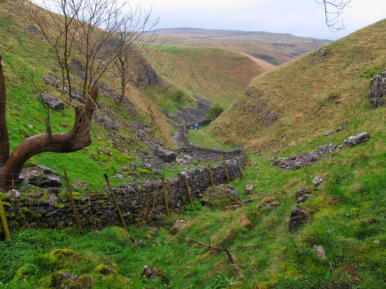
The visibility was very poor and the misty scenery was so unappealing I just kept my head down and kept going past the limestone scars, stopping just once, at the top of an outcrop of limestone known as Conistone Pie, but as fascinating as this large rock was, the surroundings were so grey and misty that I didn’t stay very long before resuming my walk along the Dales Way. It wasn’t long until I reached Scot Gate Lane and the top of Conistone Dib, which is an interesting narrow valley full of rocks and with steep grassy slopes, but I was at the top of it. Walkers on the Dales Way bypass this peculiar feature with barely a glance but I wanted to explore it and that entailed carefully climbing down the wet rocks into the valley and then walking all the way down it. There is reportedly a spectacular gorge at the bottom of the valley, but unfortunately I didn’t descend that far, which is a pity and with hindsight I wish I had descended all the way into Conistone.

Instead I climbed back out of the valley and onto the Dales Way to resume my walk south towards Grassington as the rain eventually eased. I passed more limestone features, but I wasn’t finding the scars particularly interesting while an old lime kiln near the path was more successful in drawing my attention. On this holiday I have to admit that I was not impressed with the subtle limestone features of the terrain as it seems I prefer the bolder, more dramatic features of volcanic regions like the Lake District. The botanic features of the landscape, meaning the wild flowers, were by far the biggest draw of the week, and the banks of primroses that I saw in many places were the definite highlight while the limestone scars failed to excite me (however I was impressed with the enormous limestone pavement of Moughton, near Ingleborough, which was a definite highlight despite being there when it was raining).

In a bid to find more wild flowers I turned right once I was off the open access land and headed for Grass Wood, which I’d heard was particularly good for bluebells, however I was disappointed with it. After all the wild flowers that I’d seen on this holiday Grass Wood was unable to compare favourably, though it’s probable that I was just too early and if I’d returned a couple of weeks later I would have seen a stunning display of wild flowers, particularly bluebells. As I made my way through the wood I did see many wild flowers but they were not in the abundant numbers that I had seen in such places as on my first day of this holiday, near Aysgarth Falls. Despite the scarcity of woodland flowers I did think it was a charming wood as I negotiated a course past Gregory Scar and around Dewbottom Scar descending to the road at the bottom of the valley.

In the narrow strip of land between the road and the river I found a much more abundant display of wild flowers including banks of bluebells newly in flower. Primroses and wood anemones were also on display that went some way to reducing my disappointment in Grass Wood. I think my problem is that I’ve seen better, but timing is so critical with woodland flowers that I could come back a week later and find a completely different display. A delightful walk beside the River Wharfe took me through the wood to a set of rapids with the peculiar name of Ghaistrill’s Strid that were fun to explore, while clambering over the rocks beside the river to get a closer look. Continuing alongside the river I eventually rejoined the Dales Way as I walked past Grassington until I reached Linton Falls. After a good look at this waterfall that is marred by old factory buildings beside the river I made my way along a path up into the village of Grassington to the National Park Centre.

There I enquired as to the next bus to Skipton only to learn that I had just missed one and the next was an hour and a half away. My disappointment was further increased by the weather that had promptly cleared now that I had stopped walking to leave glorious sunshine for the rest of the day, however Grassington is not a bad place to spend an hour and half. This walk hadn’t been too bad, especially after the rain stopped, as I did enjoy the end of the walk wandering around Grass Wood and beside the River Wharfe. It might have only been lunchtime but I think I was ready to go home. As for the whole holiday, did I see the gems that I’d been hoping for? I saw a few gems, and not a few waterfalls, but I didn’t appreciate the difficulty in finding those gems. Ultimately the Yorkshire Dales cannot compete with the Lake District or similar places. Pot holes and limestone outcrops might not hold much interest for me, but there are things in the Yorkshire Dales that are really appealing so I'm sure I will be back, even if I have to wait another five years.