Tuesday 20th December 2022
After more than eighteen months since I was last in the Lake District and three years since I was last there at Christmas, I was eager to return to that most wonderful area for walking. However, the unreliable train service that had affected my holiday earlier in the year put me off taking the train, so I had decided to take my car, but on the day before I was due to leave the poor weather forecast for Monday convinced me to take the train after all. Even if I had taken the car the heavy rain would have made any walking worthless. After successfully catching three trains, my final train that would take me to Windermere was cancelled, so I had to finish my journey into the Lake District by bus and I arrived in the village of Coniston in the dark. That night I stayed in the Coniston Youth Hostel which was the first time that I stayed in a YHA hostel in three years. I awoke to find the clouds breaking and the promise of the best weather of the week, so I eagerly headed into Coniston and caught a bus to Water Yeat at the southern end of Coniston Water and from there I started to walk across the fells that are to the east of the lake.
I had never walked in this area before, so I was looking forward to this opportunity and with great enthusiasm I stepped off the bus in Water Yeat and along a narrow road to Bouthrey Bridge where I followed a footpath through grassy fields beside the River Crake. Despite walking through grassy fields I was still excited to be back in the Lake District with views to the south that looked promising and my first target, Brock Barrow, ahead of me whose dome of steep crags and bracken looked impregnable. The path took me to another road that led me into the tiny community of High Nibthwaite where a path departs to cross the steep southern slopes below Brock Barrow. Although a path is marked on O.S. maps straight up the steepest slopes it is not actually possible, so I veered north onto a path that heads across the western slopes. At some point I needed to climb those steep slopes, but it was difficult to know where the best route would be as there were no paths. Eventually I branched up the hill, but it might have been easier if I had waited, though with much effort I did eventually manage to pull myself up through thick bracken, gorse and heather to finally reach the fine, slender cairn that marks the summit of Brock Barrow.
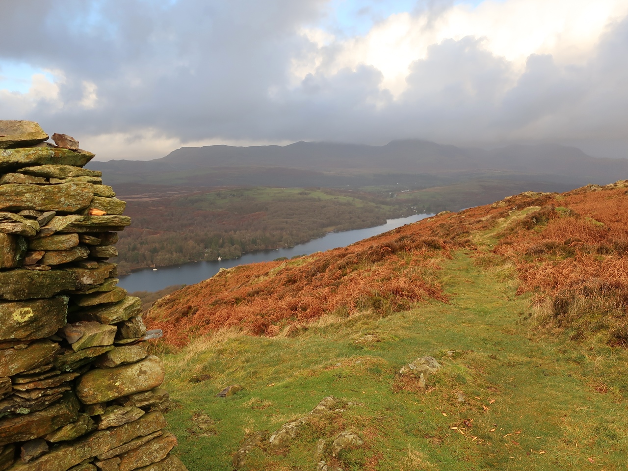
Low cloud covered the Coniston Fells so the best views were south across the Crake Valley while across Coniston Water the Blawith Fells looked like a place that would have rewarded exploration. That was where I had planned on walking the day before until bad weather changed my plans. I previously passed through the Blawith Fells in 2016 and would have appreciated an opportunity to spend more time there exploring the area which hadn’t been possible previously due to the weather. With the sun shining behind me and a brisk wind blowing it was great to be walking over the Lakeland Fells as I headed north soon reaching another cairn that would have afforded me with a classic view of the Coniston Fells if they were not hidden by clouds. Instead I turned my attention on the low hills of Bethecar Moor where I could now see that Brock Barrow was merely the southern tip of a broad ridge that slowly rises to an unseen top. I made my way through the rough vegetation of bracken and heather towards the closest top that I could see, Low Light Haw, and kept aiming for the highest ground as I slowly headed north, while enjoying the walk in the sunshine.

After Low Light Haw came High Light Haw across a rough, undulating and often boggy terrain with a brisk wind that kept me wrapped up. Beyond High Light Haw I followed a descending line of hills, but I could see that I needed to cross Stang Moss to where a line of hills break through the one thousand feet mark, so eventually I took the plunge and picked my route across the pathless terrain until finally I reached the 316 metre top at the southern end of Arnsbarrow Hill. There I had great views south into the sun and north across Arnsbarrow Hill to where I could now see the encroaching conifers of Grizedale Forest Park. The 322 metre top of Arnsbarrow Hill was rather broad and no cairn marked its location so I kept heading north passing the shallow Arnsbarrow Tarn but ignored faint paths to keep heading north until I reached Heel Toe Hill. The complexity and lack of clear paths make these low fells quite tricky to navigate, so it was satisfying to successfully reach the top of Heel Toe Hill with the edge of the conifer plantation close by. Turning my back on the conifers I headed west through the rough ground to reach the highest point in the whole area between Coniston Water and Windermere, Top o’ Selside. The O.S. marks a 335 metre top, but there is nothing on the ground at that point, though a short distance from there a cairn marks the Top o’ Selside.

A clear path led me steeply down the hill with great views to Coniston Water and across to the Coniston Fells that still looked grey despite having shaken off the low cloud. I’m sure the weather conditions at the top of those high fells would have been inhospitable thanks to strong winds as even on my low fells a brisk wind was keeping me wrapped up. On reaching a restricted byway I turned right to head north with great views before me for a pleasurable walk that had me frequently jumping over pools of water until I reached the remote farmhouse of Low Parkamoor. Staying on the track I turned towards the conifers, but rather than keeping on the track I turned off onto a horribly muddy bridleway that was often submerged in water and prompted me to take bypassing paths off it. Thankfully I soon reached the edge of Grizedale Forest Park where I soon reached a complex junction of forestry tracks and took the wrong one. I didn’t realise my mistake until I was descending into the valley of the Farra Grain Gill, but successfully managed to negotiate the maze of tracks to reach the beginning of the path up to Carron Crag. I climbed up this top almost exactly ten years ago and a good, steep, gravelly path took me inexorably all the way up to the summit crags. The trees were a lot higher and encroached on the summit more than they did ten years ago but I still had great views across the tops of the trees and towards the distant fells.
From the top of the summit rock I made my way down a good, gravelly path onto forestry tracks and could have kept to my route of 2012, but I decided not to repeat myself so I continued the descent on a bridleway that took me all the way down to Coniston Water. This descent provided me with tremendous views across Coniston Water to the village of Coniston with the Coniston Fells forming a mesmerising backdrop that made me wonder again what it would have been like this day on those tops, probably very cold and windy. The only problem with this walk was that it ended rather early, even for this time of the year, but I couldn’t think of a way that I wanted to prolong it. Instead I had a slow walk down the hill and around the head of Coniston Water back into the village. I have not been feeling well for the last couple of months so I was looking forward to going to the Lake District as recuperation and this walk was relaxing and easy enough, but it was still thoroughly enjoyable. If I’d had more energy and longer daylight hours then this walk could have been extended all the way around Coniston Water, but perhaps that wouldn’t have allowed me the time to explore the fells east of Coniston Water as much as I was able to do on this walk.


