Wednesday, 28 December 2022

Offa's Dyke Path: The Clwydian Range

Thursday 1st September 2022

Near the end of my walk the day before, while coming down through Llandegla Forest, I could see ahead of me the line of hills known as the Clwydian Range and I was excited about the prospect of walking over them. First thing in the morning, under overcast skies, I set off from the Llyn Rhys campsite through the village of Llandegla and along the Offa’s Dyke Path through grassy fields, which may not have been an inspiring start, but I was excited just to be walking again. One thing I have loved about this holiday is being able to walk every day; the weather was not a barrier to my walking at any point, so I was heartbroken to realise that I was almost at the end of my holiday. Not being able to walk long distances every day almost feels claustrophobic to me. Eventually the terrain began to steepen and I reached a road near to the southern end of the Clwydian Range. The Offa’s Dyke Path misses out many of the tops on the Clwydian Range and begins by crossing the eastern slopes of Moel y Waun. When I came off the road I took a wrong turning so when I realised my error I had to turn around, back to the road and take the correct track past a radio mast and steeply up Moel y Plâs through scorched, yellow grass and bracken.


During my climb up Moel y Plâs the sun began to come out and I had good, though hazy, views to the south and the views north, when I reached the top amongst heather, revealed the continuing range of the Clwydian hills and, as I crossed the western slopes, I had extensive views west across the Vale of Clwyd towards the distant Snowdonia National Park. Offa’s Dyke Path kept to the western slopes as I skirted around Moel Llanfair and Moel Gyw, which meant the western views were constantly drawing my eye while the path provided me with easy walking, maintained the contour around the hills. The vegetation on Moel Gyw was very colourful with the yellow of gorse, the red of bilberry and the purple of heather while the green of bracken provided the backdrop. Eventually I descended to the A494 road at the lowest crossing on the Clwydian Range, but soon branched off the road onto a farmer’s track that skirts around the eastern slopes of Gyrn. After crossing the grassy slopes of Moel Eithinen I began to climb the steep slopes of Moel Fenlli whose banks were also covered with many colourful flowers. Moel Fenlli is the second highest peak on the Clwydian Range, one of only two to reach above five hundred metres, but the Offa’s Dyke Path skirts around the western slopes, so I came off the trail and dragged myself all the way up to the summit of the prominent top.


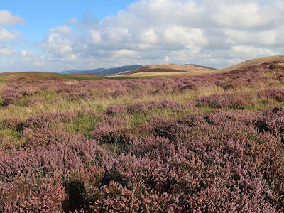
There I found a good-sized cairn and a brisk wind and also great views towards the highest point on the range, Moel Famau. After descending the steep slopes on the other side, down to the busy car park for Moel Famau Country Park, I joined the many tourists ascending the wide track across the western slopes while enjoying the fabulous west towards the mountains of Snowdonia far in the distance. Later, I came into the cold, easterly wind as I slowly approached the summit, all the way up to the Jubilee Tower, constructed at the top of the hill. There I had extensive views in all directions that included industrial Deeside to the east, west across the Vale of Clwyd and north along the gradually descending range of hills that fell all the way down to the sea, which was now clearly in view. Offa’s Dyke Path now kept to the top of the range as I sailed through a sea of gorgeous purple heather while the views under clear blue skies continued to amaze me and the brisk wind accompanied me all the way down. The undulating path passed by a cairn, over Moel Dywyll and towards Moel Llys-y-coed before a steep descent brought me down a heavily-eroded path to another road.


Wearily, I skirted the eastern slopes of Moel Arthur and after another descent to another road I had another climb up to the top of Penycloddiau. It was now quite hot and I was exhausted from the constant climbing along the undulating range of hills. While sheltered from the wind on the western slopes the sweat was pouring off me, so it was a relief to emerge into the easterly winds where I had a chance to cool down. I was mindful of the fact that Penycloddiau was the last peak on the range that I would be going over, so I lingered on the windswept, northern slopes to take in the view before me that now also included the county town of Denbigh before finally descending onto a track that took me all the way down into the valley of the River Wheeler. When I reached the village of Bodfari I waited for a bus to start my journey back to the campsite, which arrived earlier than I expected, so I was lucky to see it and the driver stopped for me. Although the weather was amazing on this walk, it was also a lot windier than I had previously been enjoying on this holiday, however I can’t complain. The views were epic on a great walk that may have completely worn me out, but it was an awesome walk and definitely the climax of the holiday.
Thursday, 15 December 2022

Offa's Dyke Path: Pontcysyllte to Pen-y-stryt

Wednesday 31st August 2022

After a very cold night I woke to sunshine and an eagerness to be going, so soon after eight o’clock I set off from the Llyn Rhys Campsite along the Offa’s Dyke Path. I had been walking along this trail in a northerly direction for a week and a half by this point and the previous day on the trail I had reached the Pontcysyllte Aqueduct so to continue I needed to get back there. A direct route took me over Ruabon Mountain while the trail goes around, but first I needed to get over Cyrn-y-Brain and the Offa’s Dyke Path was the best way to do that. Therefore, in Pen-y-Stryt, I picked up the trail and followed it up the hill, through the conifer plantation of Llandegla Forest where a signpost was missing, but I soon realised and retraced my steps to the junction that I had missed and eventually reached the top. Leaving the plantation, I entered a vast moor that was covered in heather and bilberry accompanied by the frequent squawking of grouse as they flew off when I approached. The sunshine that I had woken to was soon gone as clouds began to cover the sky, but this would only be temporary and soon I was enjoying sunshine again on this holiday. Eventually I reached a narrow road that the Offa’s Dyke Path follows for more than a mile, but at the first hint of a path on my left I turned off the road to climb over Ruabon Mountain.


The ground cover on this hill was more mixed than earlier with bracken and gorse adding to the kaleidoscope of colours, while towards the Dee Valley were fantastic views, particularly in the direction of Maesyrychen Mountain. After passing over the top of the hill I descended into a wood where a narrow footpath took me through the valley of the Trefechan Brook to Top Reservoir, which was almost empty, and where I branched off onto a network of footpaths that took me through many grassy fields to reach the village of Trevor, however, route finding was almost impossible. Any paths that I did come across were not actually right-of-ways and they led me astray. Sometimes there were multiple stiles or exits from the fields and once I took the wrong one. And eventually I reached a field that was completely overgrown with thistles and bramble, so despite having a right-of-way it could not be traversed and I had to find a way back out and onto another way down the hill. This diversion took me into the delightful wooded valley of the Tref-y-nant Brook and eventually I successfully managed to traverse the maze and reach the village of Trevor.


At Trevor Basin, I stopped beside the canal to have my lunch before setting off along the towpath to resume my walk on Offa’s Dyke Path, soon branching off to climb up to a road and towards Trevor Hall. The trail continues through adjacent woods for a great walk that was very relaxing despite some deceptive signposts and eventually I emerged to great views along the Dee Valley and towards Castell Dinas Bran. Unfortunately, the sun had chosen this moment to go in so the views were not as good as they could be and it would take a while for the sun to emerge again. Soon, I climbed onto a road that I stayed on for a long time as I crossed the steep slopes below Trevor Rocks on a Panorama Walk that slowly took me past stunning views of the Dee Valley and past the detached hill whose summit is topped by the ruins of Castell Dinas Bran. Once I was past the hill the sun came out again to show off the valley at its best, but I was now becoming more mesmerised by the steep hillside ahead of me, decorated by the rocks of Creigiau Eglwyseg. Eventually I came off the road to take a fabulous path that crosses the steep slopes in truly mountainous surroundings.


I had been looking forward to this point in my holiday for a long time and the superb path did not disappoint. I crossed the rocky gulch above Bryn Goleu onto scree slopes that were thrilling to traverse below serrated crags with awesome views into the Dee Valley and blue skies overhead. I love narrow terrace paths such as these that traverse steep slopes on rocky ground and the delights continued for a long time. After passing below Craig Arthur and Craig yr Adar rock was eventually replaced with bracken and woodland and I reached World’s End at the head of Eglwyseg Glen. Rejoining a road I climbed up onto the moorland top and back onto the route that I had taken at the beginning of the day to retrace my steps over the flagstones that easily led me through the moorland to the conifer plantation of Llandegla Forest and back to my campsite. This was an epic walk through stunning scenery. Apart from the fiasco descending through the fields to Trevor, this walk was a dream that included a colourful moorland crossing, some good woodland walking and a glorious traverse of the crags below Eglwyseg Mountain on paths that are reminiscent of those in the Lake District, and there is no greater praise.

Thursday, 8 December 2022

Offa's Dyke Path: Oswestry to Pontcysyllte

Tuesday 30th August 2022

After missing out many miles on the Offa’s Dyke Path as it crosses the plains of the Severn Valley, I was keen to pick up the trail again at the earliest possible point and the best way to do that was to use a bus, so I parked in the long stay car park for the Pontcysyllte Aqueduct and caught a bus to Oswestry. The first thing that I needed to do was find a toilet and the second was to find some drinking water as I’d forgotten to fill up before I left the campsite. Public toilets were easily found but there was not a drinking water tap there, which was really frustrating, so I walked out of Oswestry without filling up with water (I refused to buy bottled water). The Offa’s Dyke Path is more than two miles from the centre of Oswestry so, using my not very helpful Harvey Map of the trail and Google Maps, I followed the correct road out of Oswestry and through the delightful parkland of the Llanforda Estate where grand old trees stood proud amongst the grassland. Eventually I reached Candy Woods where I soon came across Offa’s Dyke Path and turned north to steadily climb along a broad path with a steep drop to my left into the Morda valley below and the ancient earthwork of Offa’s Dyke to my right. This was a lovely walk through woodland that was being shown at its best by the dappled sunshine of another day of fabulous weather.


I had planned to walk through these woods the day before, on one of a number of short walks planned that, except for Llanymynech Rocks, were all abandoned in favour of spending a few more hours in the Shropshire Hills, so it was great to be able to find a way to incorporate them into my schedule. At the end of the wood was an old racecourse, although there is very little of it left now as it is long time since abandoned, but harebells decorated the site and it was pleasant walking. All too soon I came onto a road that I was forced to walk along for far too long and things didn’t improve afterwards as I walked through grassy fields with the dyke alongside. My tedium was caused by the uninteresting terrain underfoot and views that were heavily restricted with the best being a long distance away, far to the east across the plains of North Shropshire. The trail improved slightly as I climbed Selattyn Hill, but avoided the summit although an information point directed me towards the tower that sits at the top of the hill. I resisted the temptation and kept to the trail heading back down the hill along a green lane with tantalising views north. After crossing the Craignant valley and climbing the hill opposite my views now included Chirk Castle and also the extensive but tedious Cheshire Plain.


I felt I was walking on the edge of upland, while the rather flat countryside of England was just to my left and I wished I could see to my right into Wales where there must be lovely hills, but the terrain just rose to higher hills that blocked my view. The Offa’s Dyke Path was keeping to the Welsh border at this point, but when I reached the bottom of the beautiful valley that carries the River Ceiriog the border turns east to follow the river. The trail crosses the border many times while on its course north from the Severn Estuary to the Irish Sea, but this was the last time it crossed the border and from now on the trail stayed in Wales all the way to the sea at Prestatyn. The official route of Offa’s Dyke Path turns left after crossing the valley but a summer variant climbs the hill to reach the National Trust property of Chirk Castle. I was not interested in visiting the castle so after climbing up to the top and taking a look at the extensive views north I headed down the driveway north, but I should have gone west so when I realised I turned left at a crossroads to reach the car park where I was able to take the correct path through parkland to reach a road and the official route of Offa’s Dyke Path.

The official route may actually be better, especially in spring when wildflowers can be seen in the woods, but from this point on I had a rather tedious walk along roads and occasional paths as I slowly descended into the Dee Valley. After crossing the busy A5 road I walked alongside Offa’s Dyke for the last time on the Offa’s Dyke Path before reaching the Shropshire Union Canal (Llangollen Branch). I now had a pleasant walk beside the canal through Offa’s Dyke as it drops through the canal and down to the River Dee, and continues north passing just to the west of Wrexham while the trail heads towards Llangollen. My walk along the towing path of the Llangollen Canal took me past Froncysyllte Marina and out to Pontcysyllte Aqueduct. I previously crossed this in 2007 while returning home from Snowdonia. I don’t remember what it felt like then, but it was very scary now, especially while passing the many people who were coming the other way. Although there is a guard on one side, there is nothing into the canal or on the far side and the aqueduct is very high. I am not good with heights and even just taking a picture towards the distant Chirk Aqueduct felt as though I was taking my life into my hands, so I was relieved when I finally reached Trevor Basin on the other side of the valley.


The official route of Offa’s Dyke Path actually takes to the road, descending into the Dee Valley and for those without a head for heights it is much better. At this point I left the trail for the day and walked the short distance back to the large car park where I had left my car. The weather for this walk was fantastic, which compensated for the frequent periods that lacked interest. My main criticism of this walk was a lack of good views with the best being east towards the plains of Shropshire and Cheshire, which were extensive but dull. However, the sunshine made the walk an enjoyable day.

Thursday, 1 December 2022

Offa's Dyke Path: Shropshire Hills and Llanymynech Rocks

Monday 29th August 2022

While planning to do this section of the Offa’s Dyke Path I came up with an over ambitious route of over twenty miles but wisely abandoned it in favour of a much shorter walk two day’s previously from Knighton as far as Llanfair Hill where I had bturned around and headed back. However, that was only half way across the Shropshire Hills and after a further look at the map I realised that I had been a little presumptuous when I had abandoned it so I thought maybe my plans deserved a tweak. I had been prompted by a tedious section of the Offa’s Dyke Path south of Knighton over flat terrain on grassy fields, but the map revealed that there is a lot of gradient change on the Offa’s Dyke Path while crossing the Shropshire Hills, so it deserves a walk. After my final night in the beautiful market town of Kington, I drove through Knighton and Clun to the picturesque village of Newcastle in the Clun Valley. I didn’t bother climbing back up to the top of Llanfair Hill to rejoin the Offa’s Dyke Path at the point where I had left it and instead I joined the trail from the bottom of the valley and immediately I was climbing steeply beside the actual dyke while behind me I had views across the valley and towards Newcastle.


The dyke kept with me all the way to the Welsh border on a very strenuous, undulating route that often passed through woodland or along tree-lined paths with many changes in gradient that frequently had me thinking how many more hills were there, but there always seemed to be more to come. I started by traversing the western slopes of Graig Hill and down into the Mardu valley before climbing around Hergan to a col where I was joined by the Shropshire Way. The trail now crossed the many small ridges that radiate from the high ground to the west towards the valley of the River Unk until eventually my efforts were rewarded with a steep descent into Cwm Ffrydd at Churchtown. A steep climb followed that completely wore me out as I dragged myself all the way up to the eastern top of Edenhope Hill where extensive views were now revealed to the north east that included Stiperstones and the Long Mynd. But, to my utter dismay, I realised that I had to it all over again and descend into the upper reaches the Unk Valley and then climb through Nut Wood to the ancient drover’s road of the Kerry Ridgeway and the Welsh border.


Despite the strenuous walking this was a very interesting and exhilarating walk, so I was glad that I had taken the path. From the top of the ridge I tried to get a good view down the Vale of Montgomery and towards the Severn Valley, but despite descending some way this proved to be difficult so eventually I retraced my steps back up to the road. The bright sunshine that had been with me from the start of the walk was now starting to be smothered by clouds so any photographs would not be as good as they had been. I continued retracing my steps along the Offa’s Dyke Path down into the Unk Valley and exhaustingly back up to Edenhope Hill. I didn’t want to have to do all those undulations again so I had a look at the map to find an easier route back to Newcastle, but the Unk Valley couldn’t be avoided. Eventually I reached the road at the top of the hill where I turned right to pass along the crest of Edenhope Hill up to the broad, high ground to the west and avoid the many ups and downs of the trail. I was able to follow narrow, country lanes that minimised ascents and led me all the way back to Newcastle which lacked interest, but at least made for a speedy return under the cloudy skies.

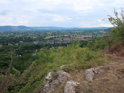
From the Ridgeway the Offa’s Dyke Path descends into the Vale of Montgomery, which despite the constant presence of the dyke seems to be frightfully dull as it crosses flat farmland. The next moment of interest on the trail is east of the town of Welshpool where there is some steep, wooded ground rising to the summit of the grandiosely named Long Mountain. After having lunch in my car I drove north past Welshpool and ignored Long Mountain, even though it might have merited a walk. After passing the Beacon Ring at the summit of Long Mountain, the Offa’s Dyke Path descends into the Severn Valley for an extended section of very dull walking and doesn’t start to climb again until after the village of Llanymynech. As I drove towards the village, the rocks of Llanymynech Hill looked impressive and dominated the view, so I parked in the village of Llanymynech and immediately joined the Offa’s Dyke Path again to head up the road towards the striking rocks that are actually the remains of quarrying. From the foot of the cliffs I already had great views south across the Severn Valley and towards the Shropshire Hills across the huge gap in the Offa’s Dyke Path that I had just missed out.


The trail skirted the edge of Llanymynech Hill through woodland but soon I came across a golf course that annoyingly sits at the top of the hill so I kept to the edge until all too soon the Offa’s Dyke Path turned sharp left to head down off the hill and I kept going around the hill, while trying to avoid the golf course as much as possible. Without a good map, I had difficulty finding my way, but eventually I did find my way back to the rocks and up to the top of the cliff edge, above the old quarry, where I had good views across the wide valley. It was quite nerve-wracking standing on the cliff edge so I soon moved away and followed the path beside the golf course, but I was unable to find a safe way down until finally I came across the right path that descends back down to the bottom. I wish I had more time to explore this area and a better map so that I knew where I was going, but I still had a lot of driving to do, so I returned to my car and headed north again. My original plan for this day had been for a series of short walks from the Offa’s Dyke Path, but this was the only one I did and even that wasn’t as long as planned. The unplanned walk from Newcastle and a lot of driving used up too much of my time this day to do anything more than this short wander around the rocks of Llanymynech Hill, but it was still an enjoyable day.