Thursday 20 May 2021

Brampton Valley Way and Pitsford Water

Saturday 10th April 2021

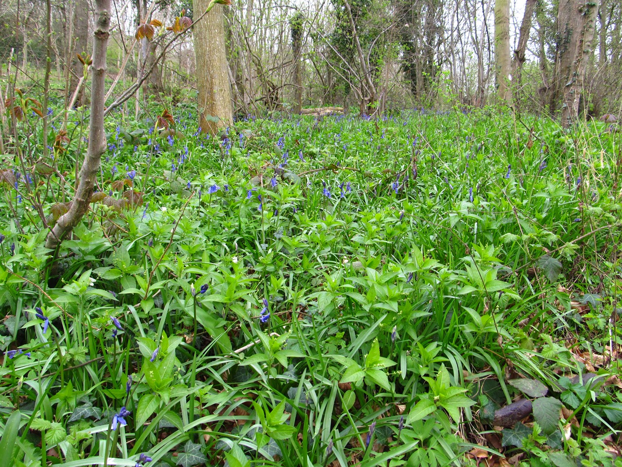
Since there were still restrictions on travel at this time I decided that for the last day of my holiday I would visit Pitsford Water in Northamptonshire, which is a place I have visited several times, but not recently. This walk was inspired by the walk I did on my first visit to the area many years ago parking at the Spratton Road crossing on the Brampton Valley Way, which runs along the old track bed of the Northampton to Market Harborough Railway. Heading south from the car park I had a pleasant stroll along the old railway line and reflected that I really must spend more time in future exploring the Brampton Valley Way and maybe even walking the whole route from Market Harborough to Northampton. I had a lovely walk at this point filled with birdsong past blackthorn hedges that were covered in white flowers and contrasted sharply against the grey, overcast skies. When I eventually reached Merry Tom Crossing I turned left off the trail onto a track that climbs out of the valley to the main road that comes out of Brixworth and after crossing the road entered the grounds of Pitsford Water. By the time I reached the reservoir it had started raining and this would continue for a long time.


Under miserable weather, but with a clear path under foot, I walked along the perimeter path and had a relaxing, straightforward walk with little undulation, but with few trees to alleviate the scenery, which does not compare well with other reservoirs that have dense woodland all around their shores, and I felt this lack of wild scenery. To be fair to the reservoir, the eastern half is heavily wooded and must be a great place to walk, but access is restricted as a nature reserve, though I would love to purchase a permit that would allow me to explore this wilder scenery, but sadly that was not on this occasion. When I reached the causeway the rain had finally begun to ease, which was a great comfort as it is always much nicer to walk when it is not raining. After crossing the causeway I turned back towards Brixworth enjoying the walk along the northern shore as the weather slowly improved along with the terrain. When I reached the woodland landscape of Brixworth Country Park I turned away from the reservoir to do a walk around the more pleasing terrain that is in park rather than elsewhere around the reservoir, but is unfortunately too small, though I have a fond memory of a previous visit finding there long grass that was alive with the sound of chirping insects.


Unfortunately this was the wrong time of the year, though when the sun came out I was prompted to nip back down to the shore to take some pictures, but soon I was climbing back through the country park onto a footpath that leaves the reservoir and enters the village of Brixworth. When I did this walk many years ago I headed straight from Brixworth onto Spratton Road back to the car park, but this road is steep and narrow so is not safe to walk on. This time I decided to take an alternative route passing through the interesting village of Brixworth past the Anglo-Saxon church of All Saints onto a footpath that took me down to the site of Brixworth railway station on the Brampton Valley Way where I turned south again and had a pleasurable walk back to the Spratton Road crossing. This was an enjoyable walk despite the poor weather, though helped by the improvement in the weather.  It had been a long time since I had been to Pitsford Water and I was surprised to see how popular it was with many people jogging along the perimeter path, though I was disappointed at the lack of interesting scenery along the southern shore of the reservoir. The Brampton Valley Way, was a lovely place and I really must find a way to walk along more of this disused railway line.

Thursday 13 May 2021

Cotswold Way - Buckland Wood to Winchcombe

Thursday 8th April 2021

The day before this walk I returned to the Cotswolds for the first time in twenty years prompted merely by its proximity to home and I was pleasantly surprised to have an enjoyable walk over the rolling hills and through wildflower-rich woodland, so I had no hesitation in returning the day after to continue my trek along the Cotswold Way. This time I parked in the market town of Winchcombe and heading out tried to find my way back to the point in Buckland Wood where I had left the Cotswold Way the day before. Rather than walk along the trail there and back again I took an alternative route, but first I had a choice whether to follow the Gloucestershire Way or the Winchcombe Way. Interesting terrain around Monk’s Hole prompted me to take the former and climbed up Fluke’s Hill through grassy fields that were decorated with very large notices proudly proclaiming: “PATH”. I have never seen that done before and I appreciated knowing which way to go up Fluke’s Hill until after passing the undulating terrain at Monk’s Hole the gradient eased and I followed a clear track past Little Farmcote. Behind me I had extensive views past Winchcombe across the Severn Valley under sunny skies that promised much better weather than I found the day before.


On reaching a road I continued to follow the Gloucestershire Way along the road and past a small quarry to the tiny hamlet of Ford where I could not find the path beside the small river that is marked on the map, but I did find an alternative path through some stables that soon brought me onto the marked route of the Winchcombe Way that I was now following through the interesting terrain of the River Windrush. While passing through the pretty, little village of Cutsdean it occurred to me that walking through farmland requires more effort in navigation than on a mountain where there is normally a clear path and your onward route is obvious. When walking through farmland it can often be difficult to know where the path goes with no sign on the ground, so you have to rely on the signposts, plus you have a legal obligation to keep to the footpath, which is not a problem on a mountain where there is open access. Thankfully the Winchcombe Way was pretty straightforward after I had climbed out of the valley where I had a gentle stroll in the increasingly warm, sunny weather keeping to a roughly northerly direction along the broad ridge that heads towards the top of Shenberrow Hill.

Just before reaching the highest point on the hill the trail turns east towards the village of Snowshill, but I could see on my map that the Winchcombe Way turns back west after Snowshill descending steeply into a valley before climbing steeply back out again. I did not need to go through Snowshill and could save myself a lot of effort by cutting the corner following a narrow farmer’s road past Great Brockhampton Farm to the point where the Winchcombe Way reappears from Snowshill beside a National Trust wood that was full of dog’s mercury and primroses. Soon I was at Buckland Wood where I had left the Cotswold Way the day before and rejoining the trail I climbed back up Shenberrow Hill along a byway under grey skies after the sunshine that I had enjoyed during the morning had deteriorated. I was now heading south and following the western edge of the broad ridge to Shenberrow Buildings where the terrain improved dramatically with a steep descent through gorgeous woodland and it was a joy to walk through the enclosed surroundings that eventually led me all the way down into the village of Stanton.

This village was filled with flowers, notably primroses, and gave me a delightful walk through the village that compensated for the tedious walking that followed as I crossed many fields and passed the impressive Jacobean manor house at Stanway until the Cotswold Way finally started to climb the ridge that had been looming ahead of me for some time. This unrelenting climb eventually brought me back up to the top of the hill where I was rewarded with extensive, though grey and misty, views behind me across the valley of the River Isbourne to Bredon Hill. The trail now crossed more tedious farmland to the escarpment edge of Coscombe Corner and the remains of the ancient settlement of Beckbury where there is also a monument that marks where Thomas Cromwell allegedly sat while watching the burning of Hailes Abbey in the valley. The Cotswold Way now descended back down the hill passing beside the delightfully decorated Hailes Wood to reach the ruins of the abbey with Winchcombe just a short distance away through more tedious farmland.


During the first half of this walk I was following the Gloucestershire and Winchcombe Ways as I tried to get back to Buckland Wood where I had left the Cotswold Way the day before and this involved a lot of road walking or along wide tracks that were not particularly exciting. But the Cotswold Way was generally along narrow paths and rewarded me with some lovely sections like the steep, wooded descent into Stanton or beautiful little villages like I found in Stanton. Despite moments of tedium on the Cotswold Way these were fleeting compared with the prolonged road walking that I endured earlier in the day when the weather was better. The Cotswold Way was also better decorated with many wildflowers, especially celandines and primroses that lifted the walk when the weather was otherwise bleak.

Friday 7 May 2021

Cotswold Way - Chipping Campden to Buckland Wood

Wednesday 7th April 2021

After two days of walking in the designated Area of Outstanding Natural Beauty of Cannock Chase, I thought I’d move on to another A.O.N.B., to one that is almost as close to me as the Chase, and that is the Cotswolds. I had been to the Cotswolds only once before, twenty years ago in the middle of September when events internationally dampened my enthusiasm for further walking, but I shouldn’t have let that prevent me from returning until now. Returning to Chipping Campden, where I had started my walk in 2001, I set off through the picturesque village where all the buildings are built from the same cream-coloured Cotswold stone and soon joined the Cotswold Way that follows a course along the western escarpment of the Cotswolds from Chipping Campden to the city of Bath. I had decided that I would start walking along this national trail, so now climbed steeply out of the village on a path that was decorated with many wild plants, though few were in flower, and this brought me to the escarpment edge of Dover’s Hill. The weather was not great as it was very cold and overcast, but it was great to be walking somewhere other than at home.


The views across the Avon Valley were grey and hazy, though the views at my feet of celandines were much more pleasing, as I walked past the trig point to the viewpoint that is the highest point on Dover’s Hill. After crossing the car park I now found that the next couple of miles on the Cotswold Way are rather dull as I walked beside a road and, after a brief interlude of a wildflower-rich copse, a very long grassy field along what the Ordnance Survey map describes as the Mile Drive. This was very tedious walking so I was relieved when I finally reached the end and after crossing a couple of arable fields reached Fish Hill Picnic Place. Primroses decorated this delightful little place and the delight continued on the other side of the A44 trunk road through a narrow wood before climbing onto the open hillside where in the distance I could tantalisingly see something peaking over the horizon. As I got nearer I discovered that it was Broadway Tower that sits at the top of Broadway Hill and is a famous landmark in the Cotswolds.


I passed this way in 2001, but I have very little memory of the walk and I am not even sure what route I had taken from Chipping Campden. I took loads of pictures now, but without the sun shining they do not look as good as they would have done if I had taken some pictures twenty years ago. After walking beyond the tower along the escarpment, I couldn’t work out where the Cotswold Way goes next until I realised I shouldn’t have passed the tower, so I retraced my steps back to the tower and down the path that descends the hillside all the way down to the bottom of Broadway Hill, one of the highest hills in the Cotswolds. This long descent shattered my knees making me wish I had brought my poles or knee support to prevent the pain. At the bottom of the hill I came into another of the picturesque Cotswold villages, in this case that of Broadway, and as I walked through I reflected that, for me, I could do without going through the villages as I prefer the natural sights of hill and plant. However, the picturesque villages are an iconic part of the Cotswolds, so the trail has got to go through them, and if only so the villages can benefit from the passing trade.

Leaving the village behind, I climbed up again to the gorgeous woodland of Broadway Coppice that was smothered in wildflowers, especially wild garlic and dog’s mercury with some primroses adding to the colour. This was sadly short lived and soon I was walking along a wide farmer’s track to a farmhouse on the edge of Buckland Wood where I turned right up to a gate and left the Cotswold Way to start my return journey back to my car in Chipping Campden. When I reached the edge of Buckland Wood, after crossing a field of horses, I stopped to have my lunch and thought about my plan for the return journey, which had involved a much longer route than already taken. I was already very tired and was soon cold, so once I had eaten I decided to head straight back to Broadway Hill (avoiding the village) and retrace my steps along the Cotswold Way. Upon returning to the farmhouse on the edge of Buckland Wood, I took a path that skirts the edge of the wood where I found an abundance of wildflowers including wild garlic that lifted my spirits despite the ramson not being in bloom.


This put a spring in my step as I tried to warm myself up after my inaction during lunch dashing along the path and even running down the hill beside Lydbrook Plantation. After a short walk beside a road I turned right opposite a church onto Coneygree Lane that climbs steeply up Broadway Hill and is decorated with the most delightful wildflowers including some early bluebells that had already bloomed. I was ecstatic as I climbed through this wonderland that also included wood anemones, primroses, dog’s mercury and violets that made me feel as light as a feather and as if I had never been fitter, I sailed up the hill. Despite feeling tired when I had eaten my lunch I was now feeling really fit and vigorous after the previous few days of feeling very tired by this point in the walk. I thought I must now be getting used to walking long distances again, and I loved it. At the top of the lane I continued the climb past some holiday cottages just as the sun tried to break through the clouds, but failed, and it was overcast again by the time I reached Broadway Tower again where I rejoined the Cotswold Way.

When planning this walk I had tried to avoid walking over the same ground again on my return, but there is something to be said for doing exactly that. When I was walking along the Mile Drive in the morning, I was constantly thinking about navigation, where the path went next, but on my return I no longer had to worry about that as I knew exactly where I was going. I could just relax and enjoy the walk, so the Mile Drive seemed considerably shorter than it had earlier and I felt it wasn’t long before I was nearing Dover’s Hill where I turned right, avoiding the top, and headed straight down towards Chipping Campden. This was a really enjoyable walk, despite the poor weather, possibly because of the abundance of wildflowers and some really satisfying ascents and descents that helped me to stretch my legs, though the highlight of the walk was off the Cotswold Way in Coneygree Lane. I don’t have fond memories of my walking in the Cotswolds in 2001, so I feared for this walk, but I was pleasantly surprised. My impression of the Cotswolds had been of farmer’s fields, tourist-filled villages and grassy hills, and this has kept me away for twenty years, but this walk proved me wrong.