Thursday 29 September 2022

Offa’s Dyke Path: Sedbury to Brockweir

Saturday 20th August 2022

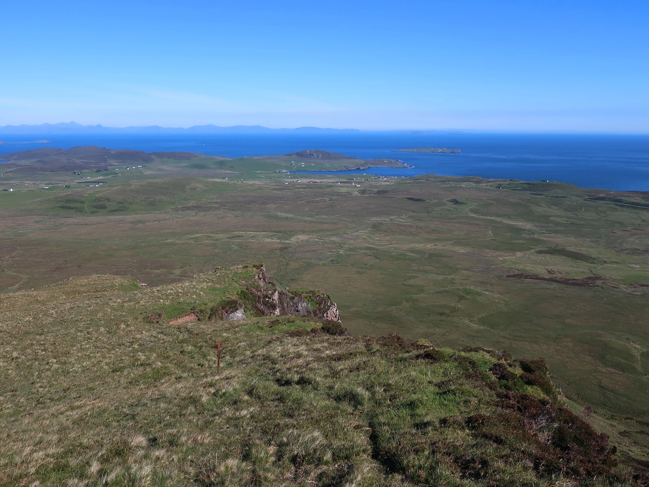
I have enjoyed doing several long distance trails in recent years, so at the beginning of this year I was idly looking through some maps wondering if I could do a trail across Wales, but the resulting walk was highly ambitious and I don’t think I have enough experience to accomplish it. I was mindful of the fact that I have never done a long distance trail that takes more than a week, so I started looking for something that would be relatively easy, but would take me more than a week and my eye strayed east on the map to the Offa’s Dyke Path. I have walked parts of this trail before, principally in the Black Mountains, and at 177 miles it is the right length. However, as I started planning I came across the problem I often get with long distance trails and that is having to book all my accommodation, which I find to be very tedious and difficult, and also very frustrating as it locks me into a schedule that I can’t change. The distance that I would be walking each day would be fixed and I hate that lack of freedom. In Scotland I am able to wild camp wherever I like so each day I can keep going until I want to stop, whether that is a long way or to cut the day short if that is how I feel, but in England and Wales I don’t have that freedom.

However a part of me really wanted to backpack the full trail so I battled with myself on how to do the Offa’s Dyke Path until a problem with the trains solved my dilemma. Engineering work was planned for over the summer that would prevent me from getting to the start and then strikes by railway workers made me realise that I couldn’t rely on the trains, so in the end I decided to take my car. I spent a very enjoyable holiday three years ago traversing Wales using my car and I was hopeful of recapturing some of that magic on this holiday. I would not be doing every mile of the Offa’s Dyke Path, but instead I would complete most of the trail as a series of round walks or with the aid of buses. Therefore, I drove to the village of Sedbury near the mouth of the River Wye and set off in the rain, which was rather ironic as we had just been through the hottest and driest summer in almost fifty years. Ignoring the route of the Offa’s Dyke Path, I took a track down to the River Severn and crossed the saltmarsh to as close to the estuary as I safely could without getting sucked into the mudflats. Across the river I could the Severn bridges through the misty weather and I was reminded of walking beside the River Forth a year ago. Even though the saltmarshes were very muddy, there were relatively dry paths further inland that I followed along the foot of Sedbury Cliffs.


At the southern end of the cliffs I climbed up to a good vantage point with views across the river and where a rock marks the start of the Offa’s Dyke Path, so turning my back on the River Severn I set off along the trail and across the stream, Slimeroad Pill, where I immediately discovered the remains of the actual medieval earthwork known as Offa’s Dyke. Offa was an eighth century king of Mercia, who is reputed to have built this dyke to defend his lands from the Welsh. There is little hard evidence about the Dyke except for the fact that it exists, so no one really know how long it originally stretched or how it was used. This brief section of Offa’s Dyke was short-lived and soon disappeared as I skirted the edge of Sedbury while the weather slowly improved so that by the time I stopped for my lunch the sun had come out. Eventually I reached the River Wye whose valley is widely acclaimed and I was looking forward to walking through it, but first I had to get out of Sedbury and even then I was frustrated at not being able to get a view of the valley as I passed through narrow enclosed lanes until eventually I started getting glimpses into a disused quarry, now part of Lancaut Nature Reserve.


Soon after passing there I emerged onto an opening above the cliffs known as Wintour’s Leap that gave me fabulous, vertiginous views across a sharp turn in the Wye Valley. It was great to finally get a view of the Wye but this was soon gone as I turned my back on it and followed the trail for a spell of alternating between crossing some fields and walking along a road until finally I left the road behind and entered a wood. There I found Offa’s Dyke again and followed it for a relaxing and enjoyable walk through the woodland, though with hardly any views out of the trees towards the valley. The footpath was well-made and tried to keep away from the dyke so the ancient earthwork can be preserved as much as possible. At the Devil’s Pulpit, I had a view from the rock pillar into the valley with the ruins of Tintern Abbey far below. When the Offa’s Dyke Path finally emerged from the trees, above the side valley of Brockweir, I finally had clear views and when I reached a junction I took the track down into Brockweir on the route of the riverside alternative. At the River Wye, I left the trail and after crossing the bridge I followed the course of an old railway into the old Tintern station.


The Old Station was very busy, so I just made my way past the crowds until I reached the river and followed it on the route of the Wye Valley Walk to the road and into Tintern. I had planned to follow the Wye Valley Walk all the way to Chepstow, but I was very tired and it was much later in the day that I’d originally planned, so I decided to have a look around Tintern, including the abbey, and wait for a bus to take me to Chepstow where Sedbury is a short distance away across the river. When I started this walk in the rain I didn’t think most of the walk would be under glorious sunshine, but that is how the day developed and it was greatly appreciated. I really needed this holiday to get away from the pressures of work and home, so I was glad to finally leave all that behind and not have to worry about it for two weeks. I had just walked eight miles along the Offa’s Dyke Path and I was looking forward to many miles to come.

Thursday 22 September 2022

Skye Trail: To Quiraing and Rubha Hunish

Friday 3rd June 2022

The night before this walk I had camped at the northern end of the Trotternish Ridge on the Isle of Skye above the escarpment near the prominent peak of Cleat, which with hindsight was rather an exposed location. It hadn’t seemed to be a windy spot when I had camped but my tent kept shaking violently with the wind blowing off the sea and kept me awake all through the night. Perhaps my tent had not been tethered as securely as it should have been, though I must have got some sleep as I was woken very early by the sound of people nearby come to view the dawn and when I gave up trying to get back off to sleep I got out of my tent to discover clear blue skies overhead and the last traces of fog lifting from the valleys, which made me wonder where was the bad weather that had kept me awake all night. Eventually I set off, though earlier than I would usually do, on the last stage of my walk along the Skye Trail, descending steeply to the road, but with a lot of pain in my big toe of my right foot, which had been a problem for me throughout the Skye Trail due to a poorly fitting inner sole.


However the view ahead towards the ancient landslip known as the Quiraing diverted my attention and is thankfully my abiding memory of this part of the walk. On crossing the road I headed off along the clear path that took me eagerly towards the Quiraing that was looking fantastic in the early morning sunshine, but I was frustrated by my difficulty in getting a good photo of the area with the rock formation known as the Prison hidden in shadow. When I previously visited the Quiraing, in 2011, the weather was much worse and I had been short of time so I hadn’t lingered as long as I would have wanted and I didn’t spend much time in the area now as I kept to the footpath that skirts the foot of the cliffs. There is a grassy plain known as the Table high amongst the rocky ground, but I have never been there partly because I don’t know how to get there, so I want to come back when I have the time to wander around climbing up and down the steep ground as much as I would like and really explore and absorb the tremendous surroundings.


Nevertheless I enjoyed the walk along the clear path that runs below the fabulous cliffs and past the stunning rock formations. The usual route for the Skye Trail turns right at the Quiraing towards Flodigarry, though I was not sure where that junction was, but fortunately I had already decided not to go that way. In order to get to Rubha Hunish as quickly as possible I decided to take the more direct alternative rather than the coastal route, so I kept to the high ground following a clear path through rocky ground up to the cliff edge and kept to the edge along the top of Sròn Vourlinn. At the end of the promontory I had fabulous views across the northern end of the Trotternish with the Outer Hebrides clearly visible across the Little Minch, but with no more high ground I had to make a steep descent through the heather down the hill where many spotted-orchids enlivened my way.


At the bottom I joined the stream, Lòn Horro that comes out of the corrie, but there is no path so it was difficult for me to force a way through the vegetation and boggy ground, though as difficult as the ground was to walk through it was delightfully decorated with wildflowers. Eventually I came to a footbridge over the River Kilmaluag, but as soon as I stepped foot onto the bridge I discovered that there was a large bird’s nest in the middle so I hastily retreated and crossed the river downstream before climbing through a field covered in wildflowers including many spotted-orchids. On reaching a road I changed my socks as my right boot was letting in water and walked along the road all the way to the coast at Port Gobhlaig where I rejoined the main path for the Skye Trail and followed a well-signposted path that took me across open heathland. Eventually I reached the Lookout Bothy that sits upon Meall Tuath above the cliffs that look over the small peninsula of Hunish.

Some say the Skye Trail starts or ends at Rubha Hunish, the northern tip of the peninsula, and I saw a few people crossing Hunish to reach the end, but in my mind I had completed the Skye Trail so I was more than happy to stop there, eat my lunch and have a rest while gazing out across the Little Minch towards the Isle of Harris in the distance. According to my Harvey Map the actual start/end of the Skye Trail is not at Rubha Hinush but on the road a mile and a half away, so after a long lunch that is where I went to finish the trail and await a bus to take me back to Portree. It was great being back on the Isle of Skye again and especially as I had such good weather particularly later in the week when the views were simply amazing and I relished the chance to do the Trotternish Ridge and revisit the Quiraing. I feel I did the Skye Trail in the right direction even though it is not the usual direction as the Trotternish Ridge should be the goal and highlight of the trail and as such it should be towards the end with this last day to Hunish as the finale of a fabulous walk through the Isle of Skye.

Thursday 15 September 2022

Skye Trail: Along the Trotternish Ridge

Thursday 2nd June 2022

Once again I woke to gorgeous views and sunshine, but this time there were no midges as I was in Portree, the largest town on the Isle of Skye, and before catching a bus I took the opportunity to briefly walk around the area. Straight out of the youth hostel I was confronted by tremendous views across Loch Portree towards the distant Cuillin Hills with the sharp peak of Sgurr nan Gillean arresting my attention. Turning left I followed the coastline on a narrow path around the Lump, Sròn a’ Mhill, that was a delicious treat before getting onto a bus that took me back to the Storr where I had left the Skye Trail the day before. Unfortunately I was not alone as the Old Man of Storr has become very popular in recent years so there is now a large car park and wide paths lead the tourists up the hillside. Initially I followed the crowds, but soon diverted off the direct path to approach the Old Man of Storr from the south and pass between the tall pinnacle of rock and the mountain. The Cuillin could still be seen in the distance, but my attention was centred on the awesome rock scenery all around me caused by ancient landslides that have produced a fabulous landscape and can be seen in many feature films. Tearing myself away I headed north below the escarpment following a level path that crosses the northern slopes of the Storr above Coire Scamadal.


When this path began to descend I decided it was time to come off it onto the north ridge to climb up to the top of the Storr. The route for the Skye Trail on my Harvey Map didn’t recommend visiting the summit, but I felt that it couldn’t be ignored even though I had actually been to the top before. In 2007 I tried to walk along the Trotternish Ridge direct from Portree, which is an alternative route for the Skye Trail, but it involved a long pathless ascent that took me many hours and I do not have fond memories of that walk, so I was looking forward to exorcising those memories. From the top of the Storr I had great views in all directions, but I was particularly sentimental about seeing the Outer Hebrides in the distance, though the best views were south down the Trotternish Ridge, above the Storr Lochs and with the Cuillin Hills lining the horizon. To the north was the bulk of the Trotternish Ridge and my route for the rest of the day, so I set off down the broad western slopes to Bealach a’ Chuirn before climbing steeply up to the top of Hartaval where little violets encouraged me to keep going, which they would do throughout the Trotternish Ridge.


I now had clear views along the ridge in the bright sunshine and the escarpment looked fabulous under the clear blue skies. However, I had heard many scare stories about this ridge including the bad weather that awaits the Skye Trail walker and with my own experience of the ridge in 2007 I had been fearful of this traverse, but instead I had hardly any wind, though it did pick up as the afternoon progressed, and the skies overhead remained clear all day, though rain would later be seen falling in other parts of Skye. The views were awe-inspiring in all directions, not just along the ridge, as to the east I could see all the way towards the mainland and west across the Little Minch was the Outer Hebrides.  Another steep drop took me to Bealach Hartaval, but with the tops now beginning to diminish the next climb was less prolonged and brought me onto the level ridge of Sgùrr a’ Mhalaidh and on to Baca Ruadh. This was followed by a gradual descent to the promontory of Sgùrr a Mhadaidh Ruaidh, which my Harvey Map recommends exploring, presumably to take in the views of the Trotternish Ridge, but I ignored the promontory and bypassed it down a clear path and then up steep slopes to the top of Creag a’ Lain.


While dark clouds and rain could be seen to the west on the Waternish Peninsula, I continued to enjoy sunshine as I descended to the relatively shallow Bealach Leacaich before climbing up Flasvein. In 2007 the constant ups and downs completely wore me out while the hour became very late, the weather worsened and my accommodation in Uig was still many miles away. This time it was much earlier in the day and with the sight of the Hills of Harris before me I was able to keep going over Flasvein and down to Bealach Chaiplin where in 2007 I had turned west across the western ridge of Groba nan Each and into Corrie Amadal. This time I still had many more hills to traverse descending to Bealach Amadal, up to the fabulously rocky ridge of Beinn Mheadhonach and across to the trig point at the top of Beinn Edra. The view from this point was rather depressing as it revealed a long descent down to the lowest point on the ridge so far followed by a steep climb up the hill beyond. However, I was again thankful that I was doing the Skye Trail in a northerly direction even though it is usually done southerly, as I prefer my descents to be gradual and my ascents steep.

By this point in the afternoon the wind had picked up and was particularly strong through Bealach nan Coisichean where I started to tackle the frustratingly long ascent up the grassy slopes of Biodhe Buidhe. Eventually the gradient eased and led me all the way up to the summit where a gradual descent revealed the dramatic Quiraing and at Bealach Ollasgairte, on the only road that passes over the Trotternish Ridge, a packed car park. Since it was now gone five o’clock I decided that it would be best if I put my tent at this point despite hoping that I would reach the Flodigarry Hostel before the end of the day, but that was still several hours away and the Quiraing is too good to rush. Instead I erected my tent above the cliffs opposite the steep peak of Cleat and not far from Dùn Dubh, which was a stunning location to camp. This was a very tiring day, but through stunning scenery in fabulous weather even though it was raining on other parts of Skye. There are a lot of ups and downs on the Trotternish Ridge and it should never be underestimated as any walk along the top will take longer than expected as I found out in 2007 and again on this fabulous walk.

Thursday 8 September 2022

Skye Trail: Through Portree

Wednesday 1st June 2022

Once again on the Isle of Skye I awoke to gorgeous sunshine, stunning views, no wind and loads of midges. Eventually I set off from where I had camped for the night, above the remote settlement of Peinachorrain at the end of the Braes road that overlooks the Narrows of Raasay. My day started with a long walk along this road while enjoying the great views to be seen across the channel to the Isle of Raasay and north to the craggy hill of Beinn Tianavaig, pausing beside the memorial to the Battle of the Braes, which was fought by crofters standing up to the callous and inhuman practices of their landlord. However, by this point I was having problems with my big toe, which had given me pain two days previously on my first day of the Skye Trail, but it had not given me any problems on the second day, mainly because that was largely off-road and on level terrain. My toe hurt most on steep descents and on hard tarmac, so the undulating road was a great trial for me which prompted me to stop frequently to try and resolve the issue. I tried not to let this ruin what was a lovely walk in fabulous weather through gorgeous countryside and eventually the pain eased, and after six and a half miles of road walking and views north towards Portree and the Trotternish Ridge I finally came off the road at the bridge over the Varagill River.


After so many miles of road walking it was glorious to be walking on a footpath again as I made my way beside the Varagill River to Loch Portree while sea pinks decorated the shoreline. Despite increasingly rough ground, not helped by the tide being in, I eventually climbed away from the shore and onto the road that leads into Portree, the largest town on the Isle of Skye. With overcast skies overhead I made my way through the tourist-filled madness of Portree to the start of the short Scorrybreac Trail, which hugs the coastline east of Portree and afforded me with excellent views across Loch Portree. This wonderful path rounds the headland and heads north, but soon climbs away from the shore and I had to leave it as the Skye Trail crosses some farmer’s fields on sketchy paths that brought me to a steep climb up Sròn a’ Bhainne on what I considered to be my first proper hill climb of the Skye Trail. I was rewarded for my effort with stunning views south towards Beinn Tianavaig with the cloud-covered Cuillin far in the distance and east across the Sound of Raasay all the way to the distant mountains of Torridon on mainland Scotland.


Turning my attention north I beheld the cliff-edge of Creag Mhór where a very faint path, little more than an indentation in the grass, followed the clifftop all the way up to the trig point that sits near the top of Sithean Bhealaich Chumhaing, which is the highest point on this line of hills. Darkened clouds now hung over the Trotternish Ridge while the sun continued to shine on Raasay and I headed down the pathless slopes. It is usual to do the Skye Trail in the opposite direction to how I was doing it, which would be to head south, however I felt that would make this section of the trail very frustrating as height is gained very slowly on featureless grassy hills, whereas I was descending slowly, which is more preferable, and now I had views ahead of me of the Trotternish Ridge. The ground was often boggy, though the sight of the occasional spotted-orchid kept me going for the many miles that seemed to take forever as I slowly make my own way north until finally I reached the end of the ridge at Bearreraig Bay where water pipes plunge steeply down the hillside to the Storr Lochs Hydro-Electric Power Station.


An easy walk along the access road brought me to the main road below the Storr where I waited for a bus that would take me back to Portree. This walk had two very different halves with a frustrating road walk in the morning, though under blue skies, before a ridge walk in the afternoon that started well but deteriorated with the darkening skies into a trek across wet, grassy ground.