Friday 3rd June 2022
The night before this walk I had camped at the northern end of the Trotternish Ridge on the Isle of Skye above the escarpment near the prominent peak of Cleat, which with hindsight was rather an exposed location. It hadn’t seemed to be a windy spot when I had camped but my tent kept shaking violently with the wind blowing off the sea and kept me awake all through the night. Perhaps my tent had not been tethered as securely as it should have been, though I must have got some sleep as I was woken very early by the sound of people nearby come to view the dawn and when I gave up trying to get back off to sleep I got out of my tent to discover clear blue skies overhead and the last traces of fog lifting from the valleys, which made me wonder where was the bad weather that had kept me awake all night. Eventually I set off, though earlier than I would usually do, on the last stage of my walk along the Skye Trail, descending steeply to the road, but with a lot of pain in my big toe of my right foot, which had been a problem for me throughout the Skye Trail due to a poorly fitting inner sole.

However the view ahead towards the ancient landslip known as the Quiraing diverted my attention and is thankfully my abiding memory of this part of the walk. On crossing the road I headed off along the clear path that took me eagerly towards the Quiraing that was looking fantastic in the early morning sunshine, but I was frustrated by my difficulty in getting a good photo of the area with the rock formation known as the Prison hidden in shadow. When I previously visited the Quiraing, in 2011, the weather was much worse and I had been short of time so I hadn’t lingered as long as I would have wanted and I didn’t spend much time in the area now as I kept to the footpath that skirts the foot of the cliffs. There is a grassy plain known as the Table high amongst the rocky ground, but I have never been there partly because I don’t know how to get there, so I want to come back when I have the time to wander around climbing up and down the steep ground as much as I would like and really explore and absorb the tremendous surroundings.

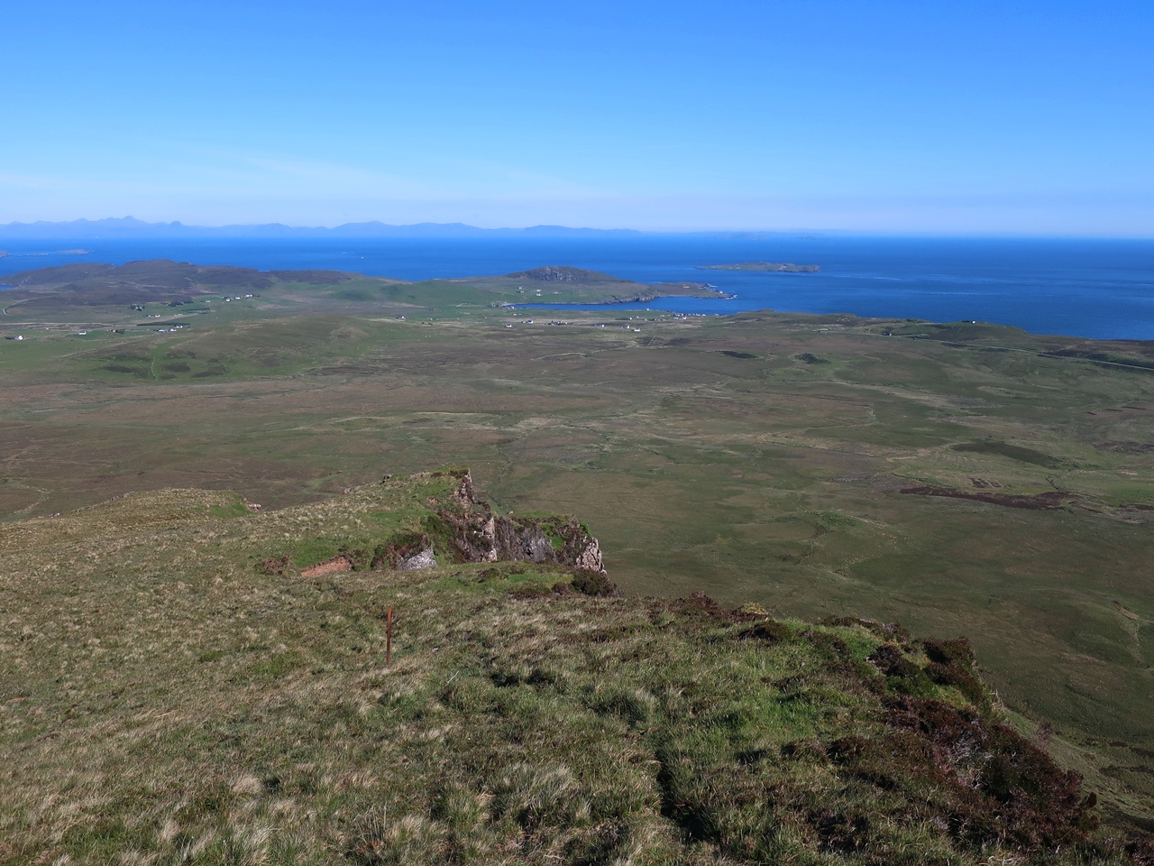
Nevertheless I enjoyed the walk along the clear path that runs below the fabulous cliffs and past the stunning rock formations. The usual route for the Skye Trail turns right at the Quiraing towards Flodigarry, though I was not sure where that junction was, but fortunately I had already decided not to go that way. In order to get to Rubha Hunish as quickly as possible I decided to take the more direct alternative rather than the coastal route, so I kept to the high ground following a clear path through rocky ground up to the cliff edge and kept to the edge along the top of Sròn Vourlinn. At the end of the promontory I had fabulous views across the northern end of the Trotternish with the Outer Hebrides clearly visible across the Little Minch, but with no more high ground I had to make a steep descent through the heather down the hill where many spotted-orchids enlivened my way.
At the bottom I joined the stream, Lòn Horro that comes out of the corrie, but there is no path so it was difficult for me to force a way through the vegetation and boggy ground, though as difficult as the ground was to walk through it was delightfully decorated with wildflowers. Eventually I came to a footbridge over the River Kilmaluag, but as soon as I stepped foot onto the bridge I discovered that there was a large bird’s nest in the middle so I hastily retreated and crossed the river downstream before climbing through a field covered in wildflowers including many spotted-orchids. On reaching a road I changed my socks as my right boot was letting in water and walked along the road all the way to the coast at Port Gobhlaig where I rejoined the main path for the Skye Trail and followed a well-signposted path that took me across open heathland. Eventually I reached the Lookout Bothy that sits upon Meall Tuath above the cliffs that look over the small peninsula of Hunish.
Some say the Skye Trail starts or ends at Rubha Hunish, the northern tip of the peninsula, and I saw a few people crossing Hunish to reach the end, but in my mind I had completed the Skye Trail so I was more than happy to stop there, eat my lunch and have a rest while gazing out across the Little Minch towards the Isle of Harris in the distance. According to my Harvey Map the actual start/end of the Skye Trail is not at Rubha Hinush but on the road a mile and a half away, so after a long lunch that is where I went to finish the trail and await a bus to take me back to Portree. It was great being back on the Isle of Skye again and especially as I had such good weather particularly later in the week when the views were simply amazing and I relished the chance to do the Trotternish Ridge and revisit the Quiraing. I feel I did the Skye Trail in the right direction even though it is not the usual direction as the Trotternish Ridge should be the goal and highlight of the trail and as such it should be towards the end with this last day to Hunish as the finale of a fabulous walk through the Isle of Skye.
No comments:
Post a Comment