Saturday 27th May 2023
Despite a lovely evening beside the Potrail Water near the Dalveen Pass, I did not get a good night’s sleep before this walk and therefore I was very tired as I set off along the Southern Upland Way for my seventh day on the trail. During the previous couple of days I had climbed over some of the highest hills on the trail including the top of Lowther Hill, which at 725 metres is the highest point on the Southern Upland Way and at the end of the day I had camped at the foot of the hill within sight of the golf ball shaped radar station that is at the summit. Since my second day on the trail I had been ahead of schedule but I was booked to stay in Moffat so I would have to give it all up, which I was happy to do as I felt like I needed an easier walk after the previous couple of days. Initially I headed into Watermeetings Forest, which, on paper, is a conifer plantation, but in fact I found a lot of deciduous trees had been planted alongside the trail on an excellent path that was a pleasure to walk upon. The track soon left the wood and crossed the northern slopes of Comb Law before reaching a post that proclaimed that I had reached the half way point on the Southern Upland Way, 107 miles from Portpatrick and just 107 miles to Cockburnspath. Since it had taken me just over six days to reach this point, I figured I would reach the end of the trail around midday on Friday, which was exactly on schedule.

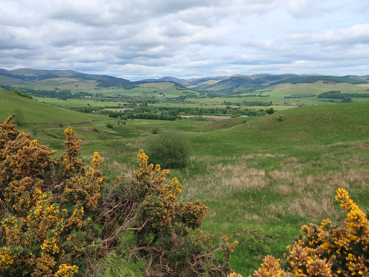
The southern hills of the grassy Lowthers dominated my view south and were pleasing to gaze upon but the views north were ruined by the vast Clyde Wind Farm. At a junction I came across a sign that diverted me away from the dam for Daer Reservoir, due to construction works, and took me down the road, across the Daer Water and up towards the waterworks buildings. On the way I passed an old Southern Upland Way signpost which reveals that the diversion was actually taking me along the original route of the trail. After crossing Hapturnell Burn, at the gates to the waterworks, a signpost directed me up the hill, around the buildings and slowly up the grassy slopes of Sweetshaw Brae. Behind me were stunning views across the Daer Valley and towards the Lowther Hills where the golf ball was still clearly visible, and I was prompted to stop many times to take in the view during my ascent. Eventually I rejoined the current route of the Southern Upland Way, beside a fence, and followed that up the hill and along the wide grassy ridge. The wind picked up as I cruelly climbed again to reach the top of Hods Hill where the fence turned to the south and the views east were revealed across Annandale and towards the Moffat Hills which include some of the highest hills in the Southern Uplands. However, to the south the view extended all the way down Annandale to the Solway Firth and on the horizon was a line of high hills that I realised, with excitement, were the fells of the Lake District.

My tantalising glimpse of that most beautiful of landscapes was soon lost as I descended alongside a conifer plantation and after passing over Beld Knowe I turned into Greskine Forest to slowly descend through a delightful landscape decorated with the yellow flowers of tormentil and broom. Large areas of the plantation have been felled, which gave my descent an airy feel and afforded me with good views down the valley and across to the high Moffat Hills. Soon after crossing the Cloffin Burn I turned off to head along an astonishingly muddy path towards Brattleburn Bothy, which was a disappointing place, but I stopped there to have my lunch. After returning to the Southern Upland Way, I found that this path was also boggy and frustratingly climbed over Craig Hill before crossing into the valley of the Garpol Water. I was now in thicker woodland that was less interesting to walk through but at least provided me with some shade from the sun. I slowly made my way through this dull terrain past tall trees that were blocking all my views so I was relieved when I eventually reached the Earshaig Lochans and the Crooked Road. Turning right, I joined the long distance trails of, first, the Romans and Reivers Route, and then the Annandale Way as the road weaved through the landscape and down into the valley of the River Annan with views across to the Moffat Hills.
Eventually I reached the village of Beattock where this stage of the Southern Upland Way ends having come twenty miles from Wanlockhead, where I had originally planned to start, even though I still had several miles to go until I reached my overnight accommodation in Moffat. With hindsight, it is a good thing that I was ahead of schedule as this was not turning out to be a short day even with starting after the Lowther Hills. It is amazing to think how strenuous this day would have been if I’d walked all the way from Wanlockhead over the Lowther Hills, the highest point on the whole trail, and then around the hills that surround Daer Reservoir. Fortunately I had been ahead of schedule so it was only mid-afternoon when I reached Beattock and after passing below the motorway I turned off the Southern Upland Way and followed the Annandale Way into the town of Moffat. There was little of interest on this walk, but most significantly I passed the halfway point so it was all downhill from here on!
No comments:
Post a Comment